Category:1900s maps of Austria-Hungary
Jump to navigation
Jump to search
Subcategories
This category has the following 6 subcategories, out of 6 total.
Media in category "1900s maps of Austria-Hungary"
The following 53 files are in this category, out of 53 total.
-
Austria-Hungary 1900.jpg 1,677 × 1,276; 346 KB
-
Revúca BV035893925.jpg 8,838 × 7,228; 11.2 MB
-
1902 Austrian military map.jpg 3,061 × 4,944; 2.48 MB
-
Huedin BV043900144.jpg 14,406 × 11,102; 30.4 MB
-
Abaúj-Torna BV044875267.jpg 3,105 × 2,671; 1.16 MB
-
Bratislava BV044875195.jpg 3,485 × 3,168; 2.18 MB
-
Komitat Altsohl BV044875255.jpg 3,896 × 2,808; 1.45 MB
-
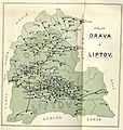
Komitat Arva BV044875238.jpg 2,420 × 2,543; 992 KB
-
Komitat Hont BV044875235.jpg 2,968 × 3,205; 1.53 MB
-
Komitat Komárom-Esztergom BV044875301.jpg 4,527 × 2,998; 1.62 MB
-
Komitat Nógrád BV044875248.jpg 2,714 × 2,886; 896 KB
-
Komitat Zemplín BV044875281.jpg 3,281 × 4,181; 2.03 MB
-
Komorn (Slowakei) BV035904634.jpg 9,989 × 7,793; 9.05 MB
-
Soltvadkert BV043900398.jpg 14,404 × 11,102; 25.24 MB
-
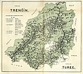
Trenčín (Okres) BV044875211.jpg 3,225 × 2,878; 1.62 MB
-
Trenčín BV035880571.jpg 9,978 × 7,816; 12.14 MB
-
Târgu Lăpuş BV043869800.jpg 14,408 × 11,102; 23.99 MB
-
Ungarn BV044875157.jpg 3,384 × 2,466; 1.28 MB
-
Šariš BV044875287.jpg 3,645 × 2,629; 1.52 MB
-
Dunaföldvár BV043899980.jpg 14,406 × 11,102; 25.99 MB
-
Gherla BV043881162.jpg 14,408 × 11,102; 31.62 MB
-
Modern history; Europe (1904) (14785707023).jpg 2,960 × 2,020; 1.51 MB
-
Stará Bystrica BV035879291.jpg 10,026 × 7,900; 12.95 MB
-
Transkarpatien BV035894144.jpg 8,826 × 6,953; 10.98 MB
-
Turda BV043865893.jpg 14,406 × 11,102; 32.08 MB
-
Uherský Ostroh BV035880562.jpg 10,026 × 7,924; 12.4 MB
-
Göding BV035880256.jpg 10,002 × 7,840; 10.78 MB
-
Kysucké Nové Mesto BV035879243.jpg 10,025 × 7,828; 12.89 MB
-
Marmarosch BV043869794.jpg 14,406 × 11,102; 22.33 MB
-
Vizovice BV035880039.jpg 9,990 × 7,804; 11.91 MB
-
Austria-Hungary LOC 2007627460.tif 8,471 × 6,365; 154.26 MB
-
Maków Podhalański BV035874795.jpg 10,073 × 7,792; 12.68 MB
-
Lučenec BV035894929.jpg 8,442 × 7,061; 10.9 MB
-
The Harmsworth atlas and Gazetter 1908 (135849246).jpg 12,526 × 9,571; 115.31 MB
-
The Harmsworth atlas and Gazetter 1908 (135849288).jpg 9,566 × 12,561; 129.62 MB
-
The Harmsworth atlas and Gazetter 1908 (135849312).jpg 6,410 × 9,567; 61.7 MB
-
The Harmsworth atlas and Gazetter 1908 (135849319).jpg 8,673 × 5,553; 63.96 MB
-
Bačka Palanka BV042104313.jpg 9,641 × 7,395; 11.41 MB
-
Caraşova BV042104711.jpg 9,720 × 7,395; 13.97 MB
-
Deta BV042104428.jpg 9,673 × 7,395; 10.29 MB
-
Gudurica BV042104703.jpg 9,720 × 7,395; 13.16 MB
-
Košice BV035894040.jpg 9,966 × 7,816; 11.37 MB
-
Maramureş (Judeţ) BV035904945.jpg 8,886 × 7,252; 12.22 MB
-
Neunkirchen (Niederösterreich Region) BV035904959.jpg 9,989 × 7,888; 13.57 MB
-
Turka (Ukraine) BV035880275.jpg 8,826 × 6,977; 11.03 MB
-
Vršac BV042104694.jpg 8,904 × 7,397; 10.44 MB
-
Zrenjanin BV042104364.jpg 8,759 × 7,396; 9.4 MB
-
Ács (Ungarn) BV035904973.jpg 9,918 × 7,756; 9.49 MB
-
Austria-Hungary WDL40.png 1,362 × 1,024; 2.94 MB
-
Judeţ Neamţ BV043900304.jpg 14,408 × 11,102; 32.2 MB


