Category:18th-century maps of Siberia
Jump to navigation
Jump to search
Subcategories
This category has the following 6 subcategories, out of 6 total.
Media in category "18th-century maps of Siberia"
The following 59 files are in this category, out of 59 total.
-
Kamchatka Remizov 1700.jpg 696 × 916; 349 KB
-
Ремезовтың сызба кітабы (44 бет).jpg 5,100 × 3,600; 15.24 MB
-
С.У.Ремезовтың сызба кітабындағы Байкал.jpg 5,100 × 3,600; 13.08 MB
-
Ремезовтың сызба кітабындағы қалмақтардың (жоңғарлардың) қоныстануы.jpg 3,360 × 2,357; 5.93 MB
-
BV014261263.tif 7,992 × 5,485; 66.4 MB
-
Russland BV014261263.jpg 7,992 × 5,485; 5 MB
-
Map of Tartary (northeastern Asia) 1719.jpg 850 × 1,021; 163 KB
-
Карта Евреинова и Лужина.png 1,536 × 960; 762 KB
-
Фрагмент карты Лужина 1722 года.png 4,383 × 5,281; 25.1 MB
-
"Douzième et dernière feuille de la Tartarie chinoise" (mention ms) - btv1b8491636j.jpg 5,865 × 6,405; 4.48 MB
-
Карта Камчатки Шестакова.jpg 669 × 859; 214 KB
-
1734 map of the Russian Empire by Ivan Kirilov.jpg 9,000 × 5,661; 14.31 MB
-
Map of Siberia2.jpg 800 × 600; 141 KB
-
Tartary1752ne.jpg 800 × 600; 136 KB
-
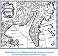
Карта Камчатки 1755.jpg 696 × 669; 253 KB
-
Карта Плениснера.jpg 785 × 639; 140 KB
-
Rigobert-Bonne-Atlas-de-toutes-les-parties-connues-du-globe-terrestre MG 0006.tif 5,214 × 3,498; 52.21 MB
-
1780 Raynal and Bonne Map of Russia - Geographicus - Russia-bonne-1780.jpg 2,500 × 1,712; 1.35 MB
-
Interiors of Tsaritsyno P1070268.JPG 3,000 × 4,000; 3.81 MB
-
Russia Asiatica - divisa nelle sue Provincie.jpg 11,138 × 8,428; 17.17 MB
-
1787-Carte de la Russie asiatique ou Tartarie russe.jpg 1,024 × 759; 223 KB
-
Carte générale de l'Empire de Russie - btv1b8491991s (1 of 2).jpg 10,764 × 9,274; 17.56 MB
-
Carte générale de l'Empire de Russie - btv1b8491991s (2 of 2).jpg 9,504 × 9,226; 13.63 MB
-
Russia, divided into its governments (NYPL b13919861-5207406).jpg 6,388 × 4,471; 30.68 MB
-
Russia, divided into its governments (NYPL b13919861-5207406).tiff 6,396 × 4,467; 81.96 MB
-
BV035790327.tif 8,614 × 5,072; 77.14 MB
-
Russland BV035790327.jpg 8,614 × 5,072; 5.51 MB
-
Tartaria sive Magni Chami Imperium - btv1b531793378 (1 of 2).jpg 6,022 × 4,634; 4.87 MB
-
China 1689-1722 Frontier - Russia.jpg 12,280 × 6,714; 13.79 MB
-
Bellin - Carte de la Tartarie Occidentale.png 1,987 × 1,500; 4.91 MB
-
Cartouche on a map of Tartary by Bellin.jpg 901 × 1,095; 254 KB
-
Depict of Zmeinogorsk fortress map.png 433 × 500; 522 KB
-
Jacques-Nicolas Bellin, Carte De La Tartarie Occidentale (FL36380694 2622423).jpg 8,372 × 5,753; 65.39 MB
-
Map of Siberia.jpg 1,717 × 1,555; 838 KB
-
Russian Empire 1745 (Map XV HQ).jpg 9,099 × 8,326; 10.64 MB
-
Russian Empire 1745 (Map XV in Latin).jpg 7,480 × 6,851; 16.94 MB
-
Russian Empire 1745 (Map XV).jpg 2,172 × 1,920; 2.81 MB
-
Siberia2ne.jpg 800 × 600; 162 KB
-
Siberia2nw.jpg 800 × 600; 166 KB
-
Siberia2se.jpg 800 × 600; 174 KB
-
Siberia2sw.jpg 800 × 600; 173 KB
-
Siberiawest.jpg 1,458 × 981; 434 KB
-
Sibirien BV039929126.jpg 5,501 × 4,494; 4.45 MB
-
Карта Красноярского уезда 1798.jpg 6,384 × 5,111; 3.98 MB


