Category:1898 maps of South America
Jump to navigation
Jump to search
Temperate regions: North America · South America · Africa · Europe · Asia · – Polar regions: – Other regions:
| ← 1890 1891 1892 1893 1894 1895 1896 1897 1898 1899 → |
Media in category "1898 maps of South America"
The following 12 files are in this category, out of 12 total.
-

-
-

-
-
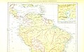
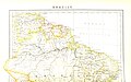
 Colombia and Venezuela. LOC 2003627059.jpg 8,710 × 6,574; 10.32 MB
-
 Colombia and Venezuela. LOC 2003627059.tif 8,710 × 6,574; 163.82 MB
-

-

-
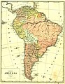 Map of South America (1898).jpg 2,948 × 3,812; 2.58 MB
-
 Mapa de 1898 del límite entre Argentina y Chile en el Campo de Hielo Patagónico Sur.jpg 2,014 × 2,699; 919 KB
-
 Mapa historico de la republica O. del Uruguay - por L. Ambruzzi... - btv1b84418964.jpg 6,360 × 11,172; 10.27 MB
-
 Südamerika, Südliche Hälfte.jpg 5,636 × 7,055; 13.81 MB
%27_(11246178095).jpg)
%27_(11248238714).jpg)
%27_(11248442414).jpg)
%27_(11248828233).jpg)

%27_(11249124685).jpg)
%27_(16403059750).jpg)
.jpg)


