Category:1898 maps of Illinois
Jump to navigation
Jump to search
States of the United States: Alaska · California · Connecticut · Florida · Georgia · Illinois · Iowa · Kentucky · Louisiana · Maryland · Michigan · Minnesota · Mississippi · Missouri · Montana · New Jersey · New Mexico · New York · North Carolina · North Dakota · Ohio · Oklahoma · Oregon · Pennsylvania · South Carolina · South Dakota · Tennessee · Texas · Virginia · Washington · West Virginia · Wisconsin – Washington, D.C.
Puerto Rico
Puerto Rico
| ← 1890 1891 1892 1893 1894 1895 1896 1897 1898 1899 → |
Subcategories
This category has the following 41 subcategories, out of 41 total.
S
Media in category "1898 maps of Illinois"
The following 27 files are in this category, out of 27 total.
-
 1898 Bird's Eye View of Chicago.jpg 18,144 × 12,992; 62.41 MB
-
 1898 Snyder's real estate map of Cook, Du Page and part of Will counties.jpg 19,044 × 22,471; 72.77 MB
-
 Adams Street Looking South 1898.JPG 636 × 449; 155 KB
-
 Bird's-eye-view of the business district of Chicago. LOC 75693212.jpg 18,144 × 12,992; 43.7 MB
-
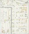
 Sanborn Fire Insurance Map from Buckley, Iroquois County, Illinois. LOC sanborn01752 001.jpg 6,450 × 7,650; 3.49 MB
-
 Sanborn Fire Insurance Map from Buckley, Iroquois County, Illinois. LOC sanborn01752 001.tif 6,450 × 7,650; 141.17 MB
-

-
 Sanborn Fire Insurance Map from Mansfield, Piatt County, Illinois. LOC sanborn01993 001-1.tif 6,450 × 7,650; 141.17 MB
-
-
 Sanborn Fire Insurance Map from Mansfield, Piatt County, Illinois. LOC sanborn01993 001-2.tif 6,450 × 7,650; 141.17 MB
-
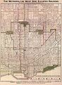 Metropolitan West Side Elevated Railroad 1898 map.jpg 1,761 × 2,400; 1.5 MB
-

-
 Sanborn Fire Insurance Map from Plymouth, Hancock County, Illinois. LOC sanborn02099 001-1.tif 6,450 × 7,650; 141.17 MB
-

-
 Sanborn Fire Insurance Map from Plymouth, Hancock County, Illinois. LOC sanborn02099 001-2.tif 6,450 × 7,650; 141.17 MB
-

-

-
 Sanborn Fire Insurance Map from Cuba, Fulton County, Illinois. LOC sanborn01811 002.jpg 6,450 × 7,650; 3.58 MB
-
 Sanborn Fire Insurance Map from Cuba, Fulton County, Illinois. LOC sanborn01811 002.tif 6,450 × 7,650; 141.17 MB
-
 Sanborn Fire Insurance Map from De Land, Piatt County, Illinois. LOC sanborn01818 001.jpg 6,450 × 7,650; 3.49 MB
-
 Sanborn Fire Insurance Map from De Land, Piatt County, Illinois. LOC sanborn01818 001.tif 6,450 × 7,650; 141.17 MB
-
 Sanborn Fire Insurance Map from Elmhurst, Du Page County, Illinois. LOC sanborn01850 002.jpg 6,450 × 7,650; 3.52 MB
-
 Sanborn Fire Insurance Map from Elmhurst, Du Page County, Illinois. LOC sanborn01850 002.tif 6,450 × 7,650; 141.17 MB
-

-
 Sanborn Fire Insurance Map from Saint Joseph, Champaign County, Illinois. LOC sanborn02140 001.tif 6,450 × 7,650; 141.17 MB
-
 Sanborn Fire Insurance Map from Westfield, Clark County, Illinois. LOC sanborn02223 001.jpg 6,450 × 7,650; 3.32 MB
-
 Sanborn Fire Insurance Map from Westfield, Clark County, Illinois. LOC sanborn02223 001.tif 6,450 × 7,650; 141.17 MB


