Category:1896 maps of California
Jump to navigation
Jump to search
States of the United States: California · Connecticut · Georgia · Idaho · Illinois · Iowa · Kansas · Kentucky · Louisiana · Michigan · Mississippi · Missouri · Montana · New Jersey · New York · North Carolina · Ohio · Oklahoma · Oregon · Pennsylvania · South Carolina · South Dakota · Tennessee · Texas · Virginia · Washington · West Virginia · Wisconsin · Wyoming – Washington, D.C.
| ← 1890 1891 1892 1893 1894 1895 1896 1897 1898 1899 → |
Subcategories
This category has the following 5 subcategories, out of 5 total.
Media in category "1896 maps of California"
The following 67 files are in this category, out of 67 total.
-

-
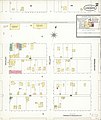
 Sanborn Fire Insurance Map from Antioch, Contra Costa County, California. LOC sanborn00387 004-1.tif 6,450 × 7,650; 141.17 MB
-

-
 Sanborn Fire Insurance Map from Antioch, Contra Costa County, California. LOC sanborn00387 004-2.tif 6,450 × 7,650; 141.17 MB
-

-
 Sanborn Fire Insurance Map from Antioch, Contra Costa County, California. LOC sanborn00387 004-3.tif 6,450 × 7,650; 141.17 MB
-

-
 Sanborn Fire Insurance Map from Antioch, Contra Costa County, California. LOC sanborn00387 004-4.tif 6,450 × 7,650; 141.17 MB
-

-
 Sanborn Fire Insurance Map from Centerville, Alameda County, California. LOC sanborn00457 003-1.tif 6,450 × 7,650; 141.17 MB
-

-
 Sanborn Fire Insurance Map from Centerville, Alameda County, California. LOC sanborn00457 003-2.tif 6,450 × 7,650; 141.17 MB
-
 Sanborn Fire Insurance Map from Delano, Kern County, California. LOC sanborn00502 003-1.jpg 6,450 × 7,650; 2.69 MB
-
 Sanborn Fire Insurance Map from Delano, Kern County, California. LOC sanborn00502 003-1.tif 6,450 × 7,650; 141.17 MB
-
 Sanborn Fire Insurance Map from Delano, Kern County, California. LOC sanborn00502 003-2.jpg 6,450 × 7,650; 2.18 MB
-
 Sanborn Fire Insurance Map from Delano, Kern County, California. LOC sanborn00502 003-2.tif 6,450 × 7,650; 141.17 MB
-
 Sanborn Fire Insurance Map from Delano, Kern County, California. LOC sanborn00502 003-3.jpg 6,450 × 7,650; 1.94 MB
-
 Sanborn Fire Insurance Map from Delano, Kern County, California. LOC sanborn00502 003-3.tif 6,450 × 7,650; 141.17 MB
-
 Sanborn Fire Insurance Map from Delano, Kern County, California. LOC sanborn00502 003-4.jpg 6,450 × 7,650; 2.08 MB
-
 Sanborn Fire Insurance Map from Delano, Kern County, California. LOC sanborn00502 003-4.tif 6,450 × 7,650; 141.17 MB
-

-
 Sanborn Fire Insurance Map from Escondido, San Diego County, California. LOC sanborn00530 002-1.tif 6,450 × 7,650; 141.17 MB
-

-
 Sanborn Fire Insurance Map from Escondido, San Diego County, California. LOC sanborn00530 002-2.tif 6,450 × 7,650; 141.17 MB
-

-
 Sanborn Fire Insurance Map from Escondido, San Diego County, California. LOC sanborn00530 002-3.tif 6,450 × 7,650; 141.17 MB
-

-
 Sanborn Fire Insurance Map from Escondido, San Diego County, California. LOC sanborn00530 002-4.tif 6,450 × 7,650; 141.17 MB
-

-
 Sanborn Fire Insurance Map from Fowler, Fresno County, California. LOC sanborn00554 002-1.tif 6,450 × 7,650; 141.17 MB
-

-
 Sanborn Fire Insurance Map from Fowler, Fresno County, California. LOC sanborn00554 002-2.tif 6,450 × 7,650; 141.17 MB
-

-
 Sanborn Fire Insurance Map from Lemoore, Kings County, California. LOC sanborn00635 004-1.tif 6,450 × 7,650; 141.17 MB
-
-
 Sanborn Fire Insurance Map from Lemoore, Kings County, California. LOC sanborn00635 004-2.tif 6,450 × 7,650; 141.17 MB
-

-
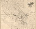 Map of the Kern Delta, Kern County, California LOC 2012590100.jpg 8,209 × 6,626; 8.91 MB
-
 Map of the Kern Delta, Kern County, California LOC 2012590100.tif 8,209 × 6,626; 155.62 MB
-

-

-
 Sanborn Fire Insurance Map from Perris, Riverside County, California. LOC sanborn00754 003-1.tif 6,450 × 7,650; 141.17 MB
-

-
 Sanborn Fire Insurance Map from Perris, Riverside County, California. LOC sanborn00754 003-2.tif 6,450 × 7,650; 141.17 MB
-
 San pedro breakwater layout 1896.png 830 × 483; 382 KB
-

-
 Sanborn Fire Insurance Map from Alvarado, Alameda County, California. LOC sanborn00381 003-1.tif 6,450 × 7,650; 141.17 MB
-
-
 Sanborn Fire Insurance Map from Alvarado, Alameda County, California. LOC sanborn00381 003-2.tif 6,450 × 7,650; 141.17 MB
-

-
 Sanborn Fire Insurance Map from Alvarado, Alameda County, California. LOC sanborn00381 003-3.tif 6,450 × 7,650; 141.17 MB
-

-
 Sanborn Fire Insurance Map from Alvarado, Alameda County, California. LOC sanborn00381 003-4.tif 6,450 × 7,650; 141.17 MB
-

-
 Sanborn Fire Insurance Map from Black Diamond, Contra Costa, California. LOC sanborn00425 002.tif 6,450 × 7,650; 141.17 MB
-

-
 Sanborn Fire Insurance Map from Byron, Contra Costa County, California. LOC sanborn00439 001.tif 6,450 × 7,650; 141.17 MB
-

-
 Sanborn Fire Insurance Map from Elmhurst, Alameda County, California. LOC sanborn00525 001.tif 6,450 × 7,650; 141.17 MB
-

-
 Sanborn Fire Insurance Map from Fernando, Los Angeles County, California. LOC sanborn00540 001.tif 6,450 × 7,650; 141.17 MB
-
 Sanborn Fire Insurance Map from Mojave, Kern County, California. LOC sanborn00692 001.jpg 6,450 × 7,650; 3.46 MB
-
 Sanborn Fire Insurance Map from Mojave, Kern County, California. LOC sanborn00692 001.tif 6,450 × 7,650; 141.17 MB
-

-
 Sanborn Fire Insurance Map from Needles, San Bernardino County, California. LOC sanborn00709 001.tif 6,450 × 7,650; 141.17 MB
-
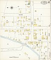
 Santa Barbara, California 1896. LOC 75693113.jpg 2,728 × 1,704; 896 KB
-
 Santa Barbara, California 1896. LOC 75693113.tif 2,728 × 1,704; 13.3 MB


.jpg)


