Category:1891 maps of Pennsylvania
Jump to navigation
Jump to search
States of the United States: California · Connecticut · Delaware · Florida · Idaho · Illinois · Iowa · Kansas · Louisiana · Maryland · Michigan · Minnesota · Missouri · Montana · New Jersey · New York · North Carolina · Ohio · Oklahoma · Oregon · Pennsylvania · South Dakota · Tennessee · Texas · Utah · Virginia · Washington · Wisconsin · Wyoming – Washington, D.C.
| ← 1890 1891 1892 1893 1894 1895 1896 1897 1898 1899 → |
Subcategories
This category has the following 30 subcategories, out of 30 total.
A
B
C
E
L
P
S
T
W
Media in category "1891 maps of Pennsylvania"
The following 23 files are in this category, out of 23 total.
-
 1891 Poor's Delaware, Lackawanna and Western Railroad.jpg 4,166 × 2,716; 2.83 MB
-
 1891 Poor's New York, Susquehanna and Western Railroad.jpg 4,166 × 2,716; 2.33 MB
-
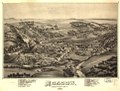
 Factoryville PA B Eye view 1891.jpg 8,088 × 5,240; 10.7 MB
-
 Factoryville, Wyoming County, Penn'a LOC 91684102.jpg 8,088 × 5,240; 9.34 MB
-
 Factoryville, Wyoming County, Penn'a LOC 91684102.tif 8,088 × 5,240; 121.25 MB
-
 Moscow, Lackawanna County, Penn'a. 1891 LOC gm71005339.jpg 6,464 × 4,912; 7.77 MB
-
 Moscow, Lackawanna County, Penn'a. 1891 LOC gm71005339.tif 6,464 × 4,912; 90.84 MB
-

-

-

-

-
-
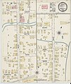
 Sanborn Fire Insurance Map from Edwardsville, Luzerne County, Pennsylvania. LOC sanborn07645 001.tif 6,450 × 7,650; 141.17 MB
-

-
 Sanborn Fire Insurance Map from Grove City, Mercer County, Pennsylvania. LOC sanborn07700 001.tif 6,450 × 7,650; 141.17 MB
-

-
 Sanborn Fire Insurance Map from Linesville, Crawford County, Pennsylvania. LOC sanborn07772 002.tif 6,450 × 7,650; 141.17 MB
-

-

-

-
 Sanborn Fire Insurance Map from Saltsburg, Indiana County, Pennsylvania. LOC sanborn07946 002.tif 6,450 × 7,650; 141.17 MB
-

-
 Sanborn Fire Insurance Map from Tionesta, Forest County, Pennsylvania. LOC sanborn08004 001.tif 6,450 × 7,650; 141.17 MB


