Category:1890s railroad maps of the United States
Jump to navigation
Jump to search
Subcategories
This category has only the following subcategory.
Media in category "1890s railroad maps of the United States"
The following 44 files are in this category, out of 44 total.
-
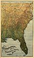
 East-tennessee-virginia-and-georgia-rr1.jpg 640 × 480; 139 KB
-
 Map of the Boston & Lowell R.R. system with its principal connections. LOC 98688600.jpg 4,447 × 5,404; 7.45 MB
-
 Map of the Boston & Lowell R.R. system with its principal connections. LOC 98688600.tif 4,447 × 5,404; 68.76 MB
-
 Map of the White Mountain District, Boston. LOC 98688600.tif 1,894 × 2,618; 14.19 MB
-

-

-
 1891 Chicago & Alton.jpg 1,477 × 1,024; 529 KB
-

-
 Ancona Illinois Ferrovia di Santa Fe 1891.jpg 1,435 × 1,023; 726 KB
-
 Map of Seattle, Lake Shore, & Eastern Railway - NARA - 55302632.jpg 14,400 × 28,094; 17.26 MB
-
 Map of Seattle, Lake Shore, & Eastern Railway - NARA - 55302640.jpg 21,882 × 12,544; 10.57 MB
-
 1892 IC.jpg 7,744 × 11,264; 13.47 MB
-
 Map of Seattle, Lake Shore, & Eastern Railway - NARA - 55302634.jpg 22,333 × 13,216; 28.53 MB
-
 1893 New Haven Railroad South Shore map.png 2,106 × 3,500; 13.43 MB
-

-
 1893 Poor's Mexican Central Railway.jpg 4,074 × 2,612; 1.71 MB
-
 1893 PRR.jpg 10,752 × 5,456; 13.16 MB
-
 1893 R&DRR FC&PRR.jpg 4,911 × 8,485; 10.39 MB
-
-
 1894 New York, New Haven and Hartford Railroad map.jpg 5,761 × 4,560; 3.01 MB
-
 1895 Massachusetts railroad map.png 4,692 × 3,500; 20.45 MB
-
 Bachman Valley Railroad map.jpg 662 × 720; 432 KB
-
 C&PD RR map 1895.jpg 593 × 712; 553 KB
-
 1895 SOU.png 1,836 × 1,329; 296 KB
-

-
 1896 SAL.jpg 4,379 × 3,361; 3.67 MB
-
 1897 Chicago railroads.jpg 6,065 × 8,173; 14.72 MB
-

-
 CGWMapCirca1897.png 522 × 524; 263 KB
-
 Chicago Great Western Railway "Maple Leaf Route." LOC 98688627.jpg 8,315 × 8,272; 14.09 MB
-
 1898 Boston and Maine Railroad.jpg 9,232 × 6,832; 15.69 MB
-

-
 Electric railway map of eastern New England (9136378205).jpg 550 × 800; 115 KB
-
 Maine Central Map 1898.jpg 3,871 × 2,266; 1.71 MB
-
 1898 ohio railroad map excerpt.gif 617 × 820; 537 KB
-

-
 1899 Massachusetts railroads map.jpg 9,384 × 7,128; 19.48 MB
-

-

-
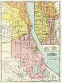
 Kansas City railroads, belt line and switches - 1893-4 (14010300215).jpg 2,000 × 1,407; 2.99 MB
-
 LIRR 1891 Morris Park station.jpg 368 × 312; 44 KB
-
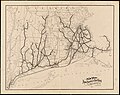
 LO&S RR map 1895.jpg 960 × 720; 205 KB
-
 Map of Illinois Central R.R. LOC 98688682.jpg 7,699 × 11,146; 14.53 MB
-
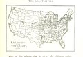
 The Great Plains, on Union Pacific system - DPLA - c00412ca049feadcf5981ab930b4eff6.jpg 7,000 × 3,417; 3.74 MB


.jpg)


.jpg)


.jpg)


.jpg)


.jpg)


.jpg)