Category:1890s maps showing history
Jump to navigation
Jump to search
Subcategories
This category has the following 24 subcategories, out of 24 total.
Media in category "1890s maps showing history"
The following 190 files are in this category, out of 190 total.
-
108 of 'Den nordiske Syvaarskrig, 1563-1570' (11211413963).jpg 1,430 × 2,333; 1,018 KB
-
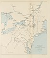
14 of 'The Irish Rebellion of 1798' (11248396026).jpg 2,016 × 1,259; 390 KB
-
187 of 'Ten Centuries of European Progress. (With maps.)' (11213284175).jpg 1,333 × 2,167; 703 KB
-
A General History for Colleges and High Schools - Map 1.png 2,076 × 3,268; 2.69 MB
-
Ancient Egypt (Myers, 1890).png 739 × 1,169; 1.78 MB
-
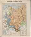
Russland BV042516513.jpg 3,214 × 4,169; 1.44 MB
-
Russland BV042516612.jpg 2,952 × 3,988; 1.46 MB
-
Russland BV042517525.jpg 3,032 × 4,235; 1.35 MB
-
North america ethnic 1500.JPG 4,800 × 3,848; 3.8 MB
-
England and France 1259.jpg 1,669 × 2,191; 1.34 MB
-
Conventus juridici in Hispania.jpg 1,003 × 778; 808 KB
-
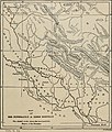
Hispania Baetica.jpg 991 × 865; 377 KB
-
Hispania.jpg 2,888 × 2,313; 837 KB
-
1893 Chart of the History of Mexico.jpg 26,014 × 19,289; 137.34 MB
-
1893 Poor's Mexican Central Railway.jpg 4,074 × 2,612; 1.71 MB
-
Hungarian leaders territories map after Conquest.jpg 720 × 464; 79 KB
-
Polska w 1000 Wojciech Ketrzynski 1894.jpg 1,006 × 1,030; 418 KB
-
The Holy Bible containing the Old and New Testaments (1896) (14579615630).jpg 3,520 × 2,204; 1,013 KB
-
The Holy Bible containing the Old and New Testaments (1896) (14579673359).jpg 3,472 × 2,136; 945 KB
-
The Holy Bible containing the Old and New Testaments (1896) (14579678139).jpg 3,472 × 2,232; 1.01 MB
-
The Holy Bible containing the Old and New Testaments (1896) (14579681229).jpg 3,472 × 2,148; 1.02 MB
-
The Holy Bible containing the Old and New Testaments (1896) (14743317066).jpg 2,272 × 3,480; 1.15 MB
-
The Holy Bible containing the Old and New Testaments (1896) (14763140771).jpg 3,664 × 2,216; 928 KB
-
The Holy Bible containing the Old and New Testaments (1896) (14763144001).jpg 2,172 × 3,528; 895 KB
-
The Holy Bible containing the Old and New Testaments (1896) (14763144541).jpg 2,232 × 2,972; 838 KB
-
The Holy Bible containing the Old and New Testaments (1896) (14763149511).jpg 3,584 × 2,300; 1.15 MB
-
The Holy Bible containing the Old and New Testaments (1896) (14765995042).jpg 2,176 × 3,512; 843 KB
-
The Holy Bible containing the Old and New Testaments (1896) (14765996672).jpg 2,196 × 3,424; 975 KB
-
World map with track of the Endeavour.jpg 1,340 × 793; 893 KB
-
HERODOTUS(1897) p2.060 MARATHON.jpg 1,067 × 911; 686 KB
-
HERODOTUS(1897) p2.187 THEMOPYLAE.jpg 1,151 × 1,792; 1.14 MB
-
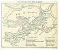
HERODOTUS(1897) p2.246 SALAMIS.jpg 1,065 × 906; 578 KB
-
Preußen 1688 1806 1815 1866.jpg 1,479 × 1,175; 466 KB
-
239 of 'American Historic Towns' (11246652316).jpg 4,297 × 2,942; 2.8 MB
-
Fabricius-Übersichtskarte der Rheinprovinz von 1789.jpg 3,618 × 5,599; 4.9 MB
-
Russland BV042516579.jpg 3,017 × 3,580; 1.49 MB
-
28 of '(Jerusalem, the City of Herod and Saladin.)' (11250213483).jpg 2,000 × 3,182; 1.07 MB
-
Caucasus map 1799.png 3,919 × 3,253; 5.85 MB
-
Charles Foster Kent, The Jerusalem of Nehemah (1899) (14596514630).jpg 2,008 × 2,620; 734 KB
-
European history - an outline of its development (1899) (14597951450).jpg 1,810 × 1,514; 293 KB
-
European history - an outline of its development (1899) (14597986398).jpg 2,384 × 1,588; 418 KB
-
European history - an outline of its development (1899) (14781497701).jpg 1,834 × 2,698; 486 KB
-
European history - an outline of its development (1899) (14782308714).jpg 1,832 × 2,430; 542 KB
-
Orbis Terrarum ad Mentem Ptolemaei.jpg 896 × 637; 256 KB
-
Our navy in time of war (1861-1898) (1899) (14779883941).jpg 1,936 × 2,840; 483 KB
-
Our navy in time of war (1861-1898) (1899) (14783039595).jpg 1,828 × 3,084; 672 KB
-
Russland BV043434115.jpg 2,317 × 2,899; 1.11 MB
-
The Old Northwest; the beginnings of our colonial system (1899) (14578268677).jpg 2,336 × 1,764; 479 KB
-
The Old Northwest; the beginnings of our colonial system (1899) (14741728696).jpg 2,320 × 1,740; 631 KB
-
19 of 'El Combate naval del Papudo el 26 de noviembre de 1865, etc' (11238530645).jpg 1,546 × 2,412; 796 KB
-
203 of 'Waterloo. A narrative and a criticism' (11232717075).jpg 1,824 × 1,246; 388 KB
-
227 of 'Ten Centuries of European Progress. (With maps.)' (11210107086).jpg 1,333 × 2,167; 742 KB
-
243 of 'The American Revolution' (11298072493).jpg 1,136 × 1,375; 236 KB
-
283 of 'The Critical Period of American History ... Illustrated, etc' (11245194073).jpg 2,224 × 1,413; 579 KB
-
310 of 'China in Transformation ... With ... maps and diagrams' (11291250283).jpg 1,287 × 1,142; 415 KB
-
33 of 'Arnold's Geographical Handbooks' (11249960505).jpg 1,224 × 1,889; 679 KB
-
355 of 'Buried Cities and Bible Countries' (11213099546).jpg 3,158 × 2,252; 1.27 MB
-
417 of 'Britain and her Rivals in the eighteenth century, 1713-1789' (11232034495).jpg 2,695 × 2,322; 977 KB
-
419 of 'Britain and her Rivals in the eighteenth century, 1713-1789' (11233442156).jpg 2,523 × 2,308; 872 KB
-
6 of 'The Critical Period of American History, 1783-1789' (11194427845).jpg 1,253 × 2,093; 510 KB
-
67 of 'The Critical Period of American History ... Illustrated, etc' (11245876235).jpg 1,413 × 2,192; 537 KB
-
Bevölkerung Mitteleuropas um 895.jpg 3,375 × 1,908; 2.44 MB
-
BielensteinLettgallenSemgallenKurenLiven1250.jpg 4,718 × 4,180; 3.59 MB
-
Brinkman Nederland Gouwverdeeling omstreeks de 10e eeuw 1890.jpg 3,555 × 4,591; 10.05 MB
-
Byzantine Constantinople.png 1,500 × 1,113; 253 KB
-
C. 1897 Ottoman Empire (1356-1897).jpg 3,138 × 4,063; 4.72 MB
-
FERNANLD(1898) SPAIN in the 12th. & 13th. Cent..jpg 881 × 926; 416 KB
-
Historická mapa - Země koruny české od časů Karla IV do války třicetileté.jpg 3,005 × 2,468; 2.09 MB
-
Historická mapa - Čechy a Morava za zřízení župního ve XII století.jpg 2,758 × 2,291; 1.31 MB
-
Historická mapa - Říše česká za knížete Boleslava II okolo roku 973.jpg 3,726 × 1,857; 1.32 MB
-
Image taken from page 15 of 'The Irish Rebellion of 1798' (11247552046).jpg 2,000 × 1,226; 424 KB
-
Image taken from page 15 of 'The Irish Rebellion of 1798' (15970383853).jpg 1,041 × 1,030; 186 KB
-
Image taken from page 227 of 'Den nordiske Syvaarskrig, 1563-1570' (11212596333).jpg 4,499 × 2,567; 2.21 MB
-
King Philip's War - 1890 - 001.svg 1,875 × 1,684; 404 KB
-
Kingdom of Bohemia during the Hussite Wars.jpg 1,151 × 861; 468 KB
-
Magyar- és Erdélyország 1629-ben (Pallas).jpg 2,280 × 1,800; 946 KB
-
Martin Behaim 1492 Ocean Map.png 1,368 × 1,362; 3.28 MB
-
MartinBehaim1492.jpg 1,388 × 1,457; 709 KB
-
Medieval-Cairo.png 2,417 × 1,511; 1.73 MB
-
OldMapKent.jpg 410 × 324; 90 KB
-
Ostdeutsche Kolonisation Putzger 1893 cropped.jpg 1,297 × 1,218; 1.26 MB
-
Our system of government (1896) (14742071036).jpg 3,484 × 2,064; 1.19 MB
-
Pauly-Wissowa III,1 749 b.jpg 1,571 × 2,203; 332 KB
-
PSM V40 D802 Port royal before the 1692 earthquake and the dotted area after.jpg 1,739 × 820; 163 KB
-
Riga um 1400 B.jpg 1,272 × 880; 388 KB
-
The Races of Mankind Before European Expansion.jpg 3,232 × 2,112; 733 KB


