Category:1888 maps of New York (state)
Jump to navigation
Jump to search
States of the United States: California · Connecticut · Florida · Georgia · Idaho · Illinois · Iowa · Kansas · Michigan · Minnesota · Missouri · Montana · New York · North Carolina · North Dakota · Ohio · Oregon · Pennsylvania · South Carolina · South Dakota · Tennessee · Texas · Virginia · Washington · Wisconsin · Wyoming – Washington, D.C.
Subcategories
This category has the following 7 subcategories, out of 7 total.
N
Media in category "1888 maps of New York (state)"
The following 59 files are in this category, out of 59 total.
-
1888 Corinth, N.Y. and Palmer Falls. LOC 75694762.jpg 8,304 × 5,584; 9.34 MB
-
All roads will lead to Buffalo in September. LOC 2004625832.jpg 5,266 × 5,036; 4.02 MB
-
All roads will lead to Buffalo in September. LOC 2004625832.tif 5,266 × 5,036; 75.87 MB
-
Bird's-eye view of Antwerp, N.Y. LOC 75694745.jpg 7,904 × 5,200; 6.62 MB
-
Bird's-eye view of Antwerp, N.Y. LOC 75694745.tif 7,904 × 5,200; 117.59 MB
-
Carthage, N.Y. 1888. LOC 75694755.jpg 9,632 × 6,384; 11.43 MB
-
Cram's township and rail road map of New York. LOC 98688528.jpg 7,056 × 5,312; 9.8 MB
-
Cram's township and rail road map of New York. LOC 98688528.tif 7,056 × 5,312; 107.24 MB
-
Driving Park Rochester NY.jpg 1,100 × 800; 1.1 MB
-
Johnstown, N.Y. 1888. LOC 75694787.jpg 9,472 × 5,584; 9.82 MB
-
Luzerne, N.Y. and Hadley. LOC 75694792.jpg 7,968 × 5,568; 8.88 MB
-
Luzerne, N.Y. and Hadley. LOC 75694792.tif 7,968 × 5,568; 126.93 MB
-
New York Presidential Election Results 1888.svg 744 × 577; 293 KB
-
Oxford, N.Y. LOC 75694827.jpg 8,904 × 5,624; 9.95 MB
-
Oxford, N.Y. LOC 75694827.tif 8,904 × 5,624; 143.27 MB
-
Political map of Connecticut 1888 and Political map of New York 1888 (7557603512).jpg 2,000 × 1,447; 2.57 MB
-
Rochester, Double Page Plate No. 10 (Map bounded by Lyell Ave., State St., Platt St., Campbell St., Whitney St.) NYPL3905024.tiff 8,585 × 6,154, 2 pages; 151.42 MB
-
Rochester, Double Page Plate No. 11 (Map bounded by Locust St., Genesee River, Lyell Ave.) NYPL3905025.tiff 8,585 × 6,154, 2 pages; 151.42 MB
-
Rochester, Double Page Plate No. 12 (Map bounded by Avenue E., N. Clinton St., Clifford St., Genesee River) NYPL3905026.tiff 8,585 × 6,154, 2 pages; 151.42 MB
-
Rochester, Double Page Plate No. 14 (Map bounded by Lowell St., N. Clinton St., Central Ave., Jones St., Vincent Pl.) NYPL3905028.tiff 8,585 × 6,154, 2 pages; 151.42 MB
-
Rochester, Double Page Plate No. 16 (Map bounded by Clifford St., German St., Wilson St., Baden St., St. Joseph St.) NYPL3905030.tiff 8,585 × 6,154, 2 pages; 151.42 MB
-
Rochester, Double Page Plate No. 17 (Map bounded by Hayward Park, Hudson St., Clifford St., N. Clinton St.) NYPL3905031.tiff 8,585 × 6,154, 2 pages; 151.42 MB
-
Rochester, Double Page Plate No. 18 (Map bounded by Norton St., Hayward Park, Avenue D, Hollenbeck St.) NYPL3905032.tiff 8,585 × 6,154, 2 pages; 151.42 MB
-
Rochester, Double Page Plate No. 19 (Map bounded by Clifford St., Ulm St., N. Goodman St., Central Park, German St.) NYPL3905033.tiff 8,585 × 6,154, 2 pages; 151.42 MB
-
Rochester, Double Page Plate No. 2 (Map bounded by W. Main St., E. Main St., Genesee River, Troup St., Favor St.) NYPL3905016.tiff 8,585 × 6,154, 2 pages; 151.42 MB
-
Rochester, Double Page Plate No. 20 (Map bounded by North St., Draper St., German St., N. Union St., University Ave.) NYPL3905034.tiff 8,585 × 6,154, 2 pages; 151.42 MB
-
Rochester, Double Page Plate No. 21 (Map bounded by N. Union St., Central Park, N. Goodman St., College Ave.) NYPL3905035.tiff 8,585 × 6,154, 2 pages; 151.42 MB
-
Rochester, Double Page Plate No. 22 (Map bounded by Clifford St., Culver Rd., N. Goodman St., Ulm St.) NYPL3905036.tiff 8,585 × 6,154, 2 pages; 151.42 MB
-
Rochester, Double Page Plate No. 23 (Map bounded by N. Goodman St., Parsells Ave., Culver St., East Ave.) NYPL3905037.tiff 8,585 × 6,154, 2 pages; 151.42 MB
-
Rochester, Double Page Plate No. 24 (Map bounded by S. Goodman St., East Ave., Culver St., Warren St.) NYPL3905038.tiff 8,585 × 6,154, 2 pages; 151.42 MB
-
Rochester, Double Page Plate No. 25 (Map bounded by Averill Ave., Pearl St., S. Goodman St., Mt. Hope Ave.) NYPL3905039.tiff 8,585 × 6,154, 2 pages; 151.42 MB
-
Rochester, Double Page Plate No. 26 (Map bounded by Frost Ave., Genesee River, Cottage St., Genesee St.) NYPL3905040.tiff 8,585 × 6,154, 2 pages; 151.42 MB
-
Rochester, Double Page Plate No. 27 (Map bounded by Magnolia St., Oakland St., Highland Ave., Elmwood Ave.) NYPL3905041.tiff 8,585 × 6,154, 2 pages; 151.42 MB
-
Rochester, Double Page Plate No. 28 (Map bounded by Thurston Rd., Genesee River) NYPL3905042.tiff 8,585 × 6,154, 2 pages; 151.42 MB
-
Rochester, Double Page Plate No. 29 (Map bounded by Pomeroy St., Campbell St., Taylor St., Genesee St., Mc. Lean St.) NYPL3905043.tiff 8,585 × 6,154, 2 pages; 151.42 MB
-
Rochester, Double Page Plate No. 30 (Map bounded by Bauer St., Whitney St., Campbell St.) NYPL3905044.tiff 8,585 × 6,154, 2 pages; 151.42 MB
-
Rochester, Double Page Plate No. 31 (Map bounded by Driving Park, genesee River, Emerson St., Bauer St., 11th St.) NYPL3905045.tiff 8,585 × 6,154, 2 pages; 151.42 MB
-
Rochester, Double Page Plate No. 32 (Map bounded by Ridge Rd., Hollenbeck St., Avenue D, Driving Park Ave.) NYPL3905046.tiff 8,585 × 6,154, 2 pages; 151.42 MB
-
Rochester, Double Page Plate No. 33 (Map bounded by Norton St., N. Goodman St., Clifford St., Hudson St.) NYPL3905047.tiff 8,585 × 6,154, 2 pages; 151.42 MB
-
Rochester, Double Page Plate No. 34 (Map bounded by Norton St., Waring Rd., Clifford St.) NYPL3905048.tiff 8,585 × 6,154, 2 pages; 151.42 MB
-
Rochester, Double Page Plate No. 4 (Map bounded by Central Ave., Scio St., Main St., Genesee River) NYPL3905018.tiff 8,585 × 6,154, 2 pages; 151.42 MB
-
Rochester, Double Page Plate No. 6 (Map bounded by Brighton Ave., S. Goodman St., Averill Ave., South Ave.) NYPL3905020.tiff 8,585 × 6,154, 2 pages; 151.42 MB
-
Rochester, Double Page Plate No. 7 (Map bounded by Troup St., South Ave., Hamilton Ave., Olean St., Ford St.) NYPL3905021.tiff 8,585 × 6,154, 2 pages; 151.42 MB
-
Rochester, Double Page Plate No. 8 (Map bounded by Troup St., S. Ford St., Olean St., Frost Ave., Genesee St.) NYPL3905022.tiff 8,585 × 6,154, 2 pages; 151.42 MB
-
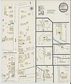
Sanborn Fire Insurance Map from Canaseraga, Allegany County, New York. LOC sanborn05802 001.tif 6,450 × 7,650; 141.17 MB
-
Sanborn Fire Insurance Map from Cherry Creek, Chautauqua County, New York. LOC sanborn05833 001.tif 6,450 × 7,650; 141.17 MB
-
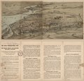
Saratoga Springs, N.Y. 1888. LOC 75694893.jpg 10,096 × 6,272; 13.61 MB


