Category:1888 UK County Locator Maps
Jump to navigation
Jump to search
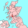
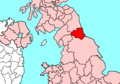
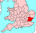
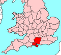
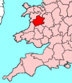
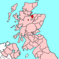
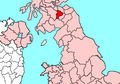
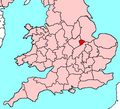
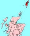
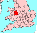
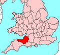
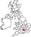
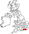
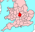
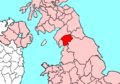
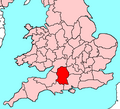
Locator maps of counties of the United Kingdom as they stood in 1888:
Media in category "1888 UK County Locator Maps"
The following 124 files are in this category, out of 124 total.
-
 AberdeenshireBrit2.PNG 608 × 604; 20 KB
-
 AberdeenshireBrit2.png 608 × 604; 15 KB
-
 AngleseyBrit6.PNG 398 × 459; 11 KB
-
 AngusBrit2.PNG 608 × 604; 20 KB
-
 AngusBrit2.png 608 × 604; 15 KB
-
 AntrimAllIreland.PNG 500 × 586; 24 KB
-
 AntrimBrit2.PNG 608 × 604; 20 KB
-
 AntrimBrit2.png 608 × 604; 15 KB
-
 AntrimBrit3.PNG 698 × 491; 28 KB
-
 AntrimBrit4.PNG 468 × 487; 15 KB
-
 AntrimBrit4.png 468 × 487; 12 KB
-
 AntrimBrit4b.PNG 468 × 487; 15 KB
-
 ArgyllBrit2.PNG 608 × 604; 20 KB
-
 ArgyllBrit2.png 608 × 604; 15 KB
-
 AyrshireBrit2.PNG 608 × 604; 20 KB
-
 BanffshireBrit2.PNG 608 × 604; 20 KB
-
 BedfordshireBrit5.PNG 625 × 569; 26 KB
-
 BerkshireBrit5.PNG 625 × 569; 26 KB
-
 BerwickshireBrit2.PNG 608 × 604; 20 KB
-
 BerwickshireBrit3.PNG 698 × 491; 28 KB
-
 BrecknockshireBrit5.PNG 625 × 569; 26 KB
-
 BuckinghamshireBrit5.PNG 625 × 569; 26 KB
-
 ButeBrit2.PNG 608 × 604; 20 KB
-
 CaernarfonshireBrit6.PNG 398 × 459; 11 KB
-
 CaithnessBrit1.PNG 493 × 606; 12 KB
-
 CambridgeshireBrit5.PNG 625 × 569; 26 KB
-
 CardiganshireBrit6.PNG 398 × 459; 11 KB
-
 CarmarthenshireBrit6.PNG 398 × 459; 11 KB
-
 CheshireBrit3.PNG 698 × 491; 28 KB
-
 CheshireBrit5.PNG 625 × 569; 26 KB
-
 ClackmannanshireBrit2.PNG 608 × 604; 20 KB
-
 CornwallBrit5.PNG 625 × 569; 26 KB
-
 CornwallBrit6.PNG 398 × 459; 15 KB
-
 CromartyshireBrit2.PNG 608 × 604; 20 KB
-
 CumberlandBrit2.PNG 608 × 604; 20 KB
-
 CumberlandBrit3.PNG 698 × 491; 19 KB
-
 DenbighshireBrit6.PNG 398 × 459; 11 KB
-
 DerbyshireBrit5.PNG 625 × 569; 26 KB
-
 DevonBrit5.PNG 625 × 569; 26 KB
-
 DorsetBrit5.PNG 625 × 569; 26 KB
-
 DumbartonshireBrit2.PNG 608 × 604; 20 KB
-
 DumfriesshireBrit2.PNG 608 × 604; 20 KB
-
 DumfriesshireBrit3.PNG 698 × 491; 28 KB
-
 DurhamBrit2.PNG 608 × 604; 20 KB
-
 DurhamBrit3.PNG 698 × 491; 19 KB
-
 EastLothianBrit2.PNG 608 × 604; 20 KB
-
 EssexBrit5.PNG 625 × 569; 26 KB
-
 FermanaghAllIreland.PNG 500 × 586; 24 KB
-
 FermanaghBrit4b.PNG 468 × 487; 15 KB
-
 FifeBrit2.PNG 608 × 604; 20 KB
-
 FlintshireBrit3.PNG 698 × 491; 28 KB
-
 FlintshireBrit6.PNG 398 × 459; 11 KB
-
 GlamorganBrit5.PNG 625 × 569; 26 KB
-
 GloucestershireBrit5.PNG 625 × 569; 26 KB
-
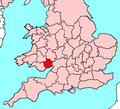
 HampshireBrit5.PNG 625 × 569; 26 KB
-
 HerefordshireBrit5.PNG 625 × 569; 26 KB
-
 HertfordshireBrit5.PNG 625 × 569; 26 KB
-
 HuntingdonshireBrit5.PNG 625 × 569; 26 KB
-
 Inverness-shireBrit2.PNG 608 × 604; 20 KB
-
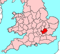
 KentBrit5.PNG 625 × 569; 26 KB
-
 KincardineshireBrit2.PNG 608 × 604; 20 KB
-
 Kinross-shireBrit2.PNG 608 × 604; 20 KB
-
 KirkcudbrightshireBrit2.PNG 608 × 604; 20 KB
-
 KirkcudbrightshireBrit3.PNG 698 × 491; 28 KB
-
 LanarkshireBrit2.PNG 608 × 604; 20 KB
-
 LancashireBrit3.PNG 698 × 491; 19 KB
-
 LeicestershireBrit5.PNG 625 × 569; 26 KB
-
 LincolnshireBrit5.PNG 625 × 569; 26 KB
-
 LondonderryAllIreland.PNG 500 × 586; 24 KB
-
 MerionethBrit6.PNG 398 × 459; 11 KB
-
 Middlesex.svg 543 × 550; 40 KB
-
 MiddlesexBrit5.PNG 625 × 569; 26 KB
-
 MidlothianBrit2.PNG 608 × 604; 20 KB
-
 MonmouthshireBrit5.PNG 625 × 569; 26 KB
-
 MontgomeryshireBrit6.PNG 398 × 459; 11 KB
-
 MorayshireBrit2.PNG 608 × 604; 20 KB
-
 NairnshireBrit2.PNG 608 × 604; 20 KB
-
 NorfolkBrit5.PNG 625 × 569; 26 KB
-
 NorthamptonshireBrit5.PNG 625 × 569; 26 KB
-
 NorthumberlandBrit2.PNG 608 × 604; 20 KB
-
 NorthumberlandBrit3.PNG 698 × 491; 19 KB
-
 NottinghamshireBrit5.PNG 625 × 569; 26 KB
-
 OrkneyBrit1.PNG 493 × 606; 12 KB
-
 OxfordshireBrit5.PNG 625 × 569; 26 KB
-
 PeeblesshireBrit2.PNG 608 × 604; 20 KB
-
 PeeblesshireBrit3.PNG 698 × 491; 28 KB
-
 PembrokeshireBrit6.PNG 398 × 459; 11 KB
-
 PerthshireBrit2.PNG 608 × 604; 20 KB
-
 RadnorshireBrit6.PNG 398 × 459; 11 KB
-
 RenfrewshireBrit2.PNG 608 × 604; 20 KB
-
 Ross-shireBrit2.PNG 608 × 604; 20 KB
-
 RoxburghshireBrit2.PNG 608 × 604; 20 KB
-
 RoxburghshireBrit3.PNG 698 × 491; 28 KB
-
 RutlandBrit5.PNG 625 × 569; 26 KB
-
 SelkirkshireBrit2.PNG 608 × 604; 20 KB
-
 SelkirkshireBrit3.PNG 698 × 491; 28 KB
-
 ShetlandBrit1.PNG 493 × 606; 12 KB
-
 ShropshireBrit5.PNG 625 × 569; 26 KB
-
 SomersetBrit5.PNG 625 × 569; 26 KB
-
 StaffordshireBrit5.PNG 625 × 569; 26 KB
-
 StirlingshireBrit2.PNG 608 × 604; 20 KB
-
 SuffolkBrit5.PNG 625 × 569; 26 KB
-
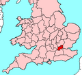
 SurreyBrit5.PNG 625 × 569; 26 KB
-
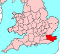
 SussexBrit5.PNG 625 × 569; 26 KB
-
 SutherlandBrit1.PNG 493 × 606; 13 KB
-
 TyroneAllIreland.PNG 500 × 586; 24 KB
-
 TyroneBrit4b.PNG 468 × 487; 15 KB
-
 Uk-avon.png 200 × 293; 10 KB
-
 Uk-beds.png 145 × 173; 6 KB
-
 Uk-berks.png 145 × 173; 6 KB
-
 Uk-cleveland.png 200 × 293; 10 KB
-
 Uk-cumberland.png 145 × 173; 6 KB
-
 Uk-durham.png 145 × 173; 6 KB
-
 Ukmap-blank.png 145 × 173; 9 KB
-
 Ukmap-buc.png 145 × 173; 6 KB
-
 Ukmap-sus.png 145 × 173; 6 KB
-
 WarwickshireBrit5.PNG 625 × 569; 26 KB
-
 WestLothianBrit2.PNG 608 × 604; 20 KB
-
 WestmorlandBrit3.PNG 698 × 491; 19 KB
-
 WigtownshireBrit2.PNG 608 × 604; 20 KB
-
 WigtownshireBrit3.PNG 698 × 491; 28 KB
-
 WiltshireBrit5.PNG 625 × 569; 26 KB
-
 WorcestershireBrit5.PNG 625 × 569; 26 KB
-
 YorkshireBrit3.PNG 698 × 491; 28 KB


