Category:1886 maps of New Jersey
Jump to navigation
Jump to search
States of the United States: California · Connecticut · Georgia · Illinois · Iowa · Kansas · Kentucky · Louisiana · Maryland · Michigan · Mississippi · Missouri · Montana · New Jersey · New Mexico · New York · Ohio · Pennsylvania · South Carolina · South Dakota · Tennessee · Texas · Utah · Virginia · West Virginia · Wisconsin · Wyoming
Puerto Rico
Puerto Rico
Subcategories
This category has the following 9 subcategories, out of 9 total.
S
Media in category "1886 maps of New Jersey"
The following 21 files are in this category, out of 21 total.
-
City of Bridgeton, New Jersey, 1886. LOC 2005626673.jpg 7,774 × 7,094; 9.89 MB
-
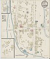
Sanborn Fire Insurance Map from Chester, Morris County, New Jersey. LOC sanborn05444 001.jpg 6,450 × 7,650; 3.26 MB
-
Sanborn Fire Insurance Map from Chester, Morris County, New Jersey. LOC sanborn05444 001.tif 6,450 × 7,650; 141.17 MB
-
Sanborn Fire Insurance Map from Clinton, Hunterdon County, New Jersey. LOC sanborn05448 001.tif 6,450 × 7,650; 141.17 MB
-
Sanborn Fire Insurance Map from Eatontown, Monmouth County, New Jersey. LOC sanborn05466 001.tif 6,450 × 7,650; 141.17 MB
-
Sanborn Fire Insurance Map from Lafayette, Sussex County, New Jersey. LOC sanborn05516 001.tif 6,450 × 7,650; 141.17 MB
-
Sanborn Fire Insurance Map from Millburn, Essex County, New Jersey. LOC sanborn05552 001.tif 6,450 × 7,650; 141.17 MB
-
Sanborn Fire Insurance Map from Port Oram, Morris County, New Jersey. LOC sanborn05605 001.tif 6,450 × 7,650; 141.17 MB
-
Sanborn Fire Insurance Map from Stanhope, Sussex County, New Jersey. LOC sanborn05632 001.tif 6,450 × 7,650; 141.17 MB
-
Sanborn Fire Insurance Map from Westfield, Union County, New Jersey. LOC sanborn05654 001.tif 6,450 × 7,650; 141.17 MB
-
The city of Woodbury, New Jersey, 1886. LOC 75694740.jpg 10,032 × 7,184; 20.17 MB
-
Whitall tatum glassworks.jpg 900 × 1,156; 124 KB


