Category:1885 maps of Georgia (U.S. state)
Jump to navigation
Jump to search
States of the United States: California · Connecticut · Delaware · Florida · Georgia · Illinois · Iowa · Kansas · Kentucky · Louisiana · Maryland · Michigan · Minnesota · Mississippi · Missouri · Nevada · New Jersey · New York · North Carolina · Ohio · Oregon · Pennsylvania · Tennessee · Texas · Virginia · Washington · Wisconsin – Washington, D.C.
| 1884 1885 1886 1887 1888 1889 → |
Subcategories
This category has the following 5 subcategories, out of 5 total.
S
Media in category "1885 maps of Georgia (U.S. state)"
The following 53 files are in this category, out of 53 total.
-
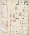
Sanborn Fire Insurance Map from Darien, Mcintosh County, Georgia. LOC sanborn01417 001.jpg 6,450 × 7,650; 4.17 MB
-
Sanborn Fire Insurance Map from Darien, Mcintosh County, Georgia. LOC sanborn01417 001.tif 6,450 × 7,650; 141.17 MB
-
Sanborn Fire Insurance Map from La Grange, Troup County, Georgia. LOC sanborn01459 001-1.jpg 6,450 × 7,650; 3.37 MB
-
Sanborn Fire Insurance Map from La Grange, Troup County, Georgia. LOC sanborn01459 001-1.tif 6,450 × 7,650; 141.17 MB
-
Sanborn Fire Insurance Map from La Grange, Troup County, Georgia. LOC sanborn01459 001-2.jpg 6,450 × 7,650; 3.49 MB
-
Sanborn Fire Insurance Map from La Grange, Troup County, Georgia. LOC sanborn01459 001-2.tif 6,450 × 7,650; 141.17 MB
-
Panoramic view of Quitman, Ga. county-seat of Brooks-County 1885. LOC 75693196.jpg 5,456 × 3,776; 3.83 MB
-
Panoramic view of Quitman, Ga. county-seat of Brooks-County 1885. LOC 75693196.tif 5,456 × 3,776; 58.94 MB
-
Panoramic view of Valdosta, Ga. - county seat of Lowndes County. LOC 77690251.jpg 6,016 × 3,808; 3.81 MB
-
Panoramic view of Valdosta, Ga. - county seat of Lowndes County. LOC 77690251.tif 6,016 × 3,808; 65.54 MB
-
Sanborn Fire Insurance Map from Barnesville, Lamar County, Georgia. LOC sanborn01382 001.jpg 6,450 × 7,650; 3.28 MB
-
Sanborn Fire Insurance Map from Barnesville, Lamar County, Georgia. LOC sanborn01382 001.tif 6,450 × 7,650; 141.17 MB
-
Sanborn Fire Insurance Map from Blackshear, Pierce County, Georgia. LOC sanborn01384 001.tif 6,450 × 7,650; 141.17 MB
-
Sanborn Fire Insurance Map from Camilla, Mitchell County, Georgia. LOC sanborn01396 001.jpg 6,450 × 7,650; 2.95 MB
-
Sanborn Fire Insurance Map from Camilla, Mitchell County, Georgia. LOC sanborn01396 001.tif 6,450 × 7,650; 141.17 MB
-
Sanborn Fire Insurance Map from Carrollton, Carroll County, Georgia. LOC sanborn01398 001.tif 6,450 × 7,650; 141.17 MB
-
Sanborn Fire Insurance Map from Cartersville, Bartow County, Georgia. LOC sanborn01399 001.tif 6,450 × 7,650; 141.17 MB
-
Sanborn Fire Insurance Map from Cedartown, Polk County, Georgia. LOC sanborn01401 001.tif 6,450 × 7,650; 141.17 MB
-
Sanborn Fire Insurance Map from Cochran, Bleckley County, Georgia. LOC sanborn01404 001.jpg 6,450 × 7,650; 3.29 MB
-
Sanborn Fire Insurance Map from Cochran, Bleckley County, Georgia. LOC sanborn01404 001.tif 6,450 × 7,650; 141.17 MB
-
Sanborn Fire Insurance Map from Cuthbert, Randolph County, Georgia. LOC sanborn01414 001.tif 6,450 × 7,650; 141.17 MB
-
Sanborn Fire Insurance Map from Dawson, Terrell County, Georgia. LOC sanborn01418 001.tif 6,450 × 7,650; 141.17 MB
-
Sanborn Fire Insurance Map from Dublin, Laurens County, Georgia. LOC sanborn01425 001.jpg 6,450 × 7,650; 3.46 MB
-
Sanborn Fire Insurance Map from Dublin, Laurens County, Georgia. LOC sanborn01425 001.tif 6,450 × 7,650; 141.17 MB
-
Sanborn Fire Insurance Map from Eastman, Dodge County, Georgia. LOC sanborn01427 001.tif 6,450 × 7,650; 141.17 MB
-
Sanborn Fire Insurance Map from Elberton, Elbert County, Georgia. LOC sanborn01430 001.jpg 6,450 × 7,650; 3.23 MB
-
Sanborn Fire Insurance Map from Elberton, Elbert County, Georgia. LOC sanborn01430 001.tif 6,450 × 7,650; 141.17 MB
-
Sanborn Fire Insurance Map from Forsyth, Monroe County, Georgia. LOC sanborn01436 001.tif 6,450 × 7,650; 141.17 MB
-
Sanborn Fire Insurance Map from Fort Gaines, Clay County, Georgia. LOC sanborn01437 001.jpg 6,450 × 7,650; 3.47 MB
-
Sanborn Fire Insurance Map from Fort Gaines, Clay County, Georgia. LOC sanborn01437 001.tif 6,450 × 7,650; 141.17 MB
-
Sanborn Fire Insurance Map from Greensboro, Greene County, Georgia. LOC sanborn01443 001.tif 6,450 × 7,650; 141.17 MB
-
Sanborn Fire Insurance Map from Madison, Morgan County, Georgia. LOC sanborn01469 001.tif 6,450 × 7,650; 141.17 MB
-
Sanborn Fire Insurance Map from Montezuma, Macon County, Georgia. LOC sanborn01478 001.jpg 6,450 × 7,650; 3.17 MB
-
Sanborn Fire Insurance Map from Montezuma, Macon County, Georgia. LOC sanborn01478 001.tif 6,450 × 7,650; 141.17 MB
-
Sanborn Fire Insurance Map from Palmetto, Fulton County, Georgia. LOC sanborn01485 001.jpg 6,450 × 7,650; 3.31 MB
-
Sanborn Fire Insurance Map from Thomaston, Upson County, Georgia. LOC sanborn01513 001.jpg 6,450 × 7,650; 3.44 MB
-
Sanborn Fire Insurance Map from Thomaston, Upson County, Georgia. LOC sanborn01513 001.tif 6,450 × 7,650; 141.17 MB
-
Sanborn Fire Insurance Map from Valdosta, Lownders County, Georgia. LOC sanborn01521 001.jpg 6,450 × 7,650; 3.74 MB
-
Sanborn Fire Insurance Map from Valdosta, Lownders County, Georgia. LOC sanborn01521 001.tif 6,450 × 7,650; 141.17 MB
-
Sanborn Fire Insurance Map from Washington, Wilkes County, Georgia. LOC sanborn01527 001.jpg 6,450 × 7,650; 3.74 MB
-
Sanborn Fire Insurance Map from Washington, Wilkes County, Georgia. LOC sanborn01527 001.tif 6,450 × 7,650; 141.17 MB
-
Sanborn Fire Insurance Map from Waynesboro, Burke County, Georgia. LOC sanborn01529 001.jpg 6,450 × 7,650; 3.68 MB
-
Sanborn Fire Insurance Map from Waynesboro, Burke County, Georgia. LOC sanborn01529 001.tif 6,450 × 7,650; 141.17 MB
-
Sanborn Fire Insurance Map from West Point, Troup County, Georgia. LOC sanborn01530 001.jpg 6,450 × 7,650; 3.97 MB
-
Sanborn Fire Insurance Map from West Point, Troup County, Georgia. LOC sanborn01530 001.tif 6,450 × 7,650; 141.17 MB


