Category:1885 maps of Africa
Jump to navigation
Jump to search
Temperate regions: North America · South America · Africa · Europe · Asia · Oceania – Polar regions: – Other regions:
| ← 1880 1881 1882 1883 1884 1885 1886 1887 1888 1889 → |
Subcategories
This category has the following 3 subcategories, out of 3 total.
Media in category "1885 maps of Africa"
The following 100 files are in this category, out of 100 total.
-
Egypt and the basin of the Nile (2674836051).jpg 1,692 × 2,000; 2.94 MB
-
SIMON(1885) p138 Plan de Gombat de Goundet.jpg 699 × 1,264; 443 KB
-
1885 map of the Arabian Peninsula and Northeast Africa by Adolf Stieler.jpg 10,561 × 8,773; 20.68 MB
-
190 of 'Tanganyika ... Second edition' (11219786416).jpg 1,168 × 2,213; 414 KB
-
24 of 'Tanganyika ... Second edition' (11216660666).jpg 2,208 × 1,136; 321 KB
-
Africa - DPLA - 0cea657b841859ba5b63c3cd948b5243.jpg 772 × 1,000; 296 KB
-
Africa - DPLA - 4bfa33a0d2a0fbb142b35fa8549632c7.jpg 848 × 1,000; 396 KB
-
Africa - DPLA - 5e01920cdc87188c8be0ffdb08771488.jpg 768 × 1,000; 239 KB
-
Africa 1885 Bartholomew.jpg 1,394 × 1,731; 347 KB
-
Africa 1885 map.png 300 × 340; 8 KB
-
African map 1885.jpg 1,400 × 1,738; 793 KB
-
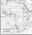
Afrika Politische Uebersicht Maerz 1885.jpg 3,000 × 2,515; 4.15 MB
-
Afrique physique - par P. Vidal Lablache... - btv1b525142375 (1 of 2).jpg 18,802 × 16,337; 61.09 MB
-
Afrique physique - par P. Vidal Lablache... - btv1b525142375 (2 of 2).jpg 18,715 × 16,318; 60.96 MB
-
Afrique politique - par P. Vidal Lablache... - btv1b525141118 (1 of 2).jpg 18,630 × 16,317; 55.28 MB
-
Afrique politique - par P. Vidal Lablache... - btv1b525141118 (2 of 2).jpg 18,618 × 16,324; 56.79 MB
-
Carte du bassin du Congo.png 9,468 × 6,844; 96.31 MB
-
Central-Afrika nach den neuesten Forschungen bearbeitet - Joseph Chavanne.jpg 9,290 × 6,416; 22.22 MB
-
Central-Afrika nach den neuesten Forschungen bearbeitet von Dr. Joseph Chavanne. LOC 98687117.tif 9,290 × 6,416; 170.53 MB
-
Deutsche kolonien 1885 afrika ausschnitt.jpg 1,600 × 1,800; 601 KB
-
Deutsche kolonien 1885.jpg 3,669 × 5,152; 2.71 MB
-
Eastern Equatorial Africa - DPLA - aa1bd2abea88012d3fabd43edc68bf23.jpg 760 × 1,000; 283 KB
-
Eastern Sahel in Politische Wandkarte von Africa im Maßstabe by Heinrich Kiepert.jpg 4,669 × 2,399; 9.71 MB
-
Esboço do Mappa do Sul da Africa - DPLA - 6a4ec73fff53300665ef49379ff3bd4f.jpg 1,000 × 661; 190 KB
-
German Claims in E. Africa - DPLA - b49196b7b5c34143bc4d8a6371970f3c.jpg 1,000 × 753; 218 KB
-
Golfe de Guinée Adamaoua 1885.jpg 504 × 369; 69 KB
-
H. Kiepert's Politische Wandkarte von Africa, Blatt 1.png 7,797 × 6,070; 62.62 MB
-
H. Kiepert's Politische Wandkarte von Africa, Blatt 2.png 7,802 × 6,049; 60.81 MB
-
H. Kiepert's Politische Wandkarte von Africa, Blatt 3.png 7,790 × 6,041; 57.1 MB
-
H. Kiepert's Politische Wandkarte von Africa, Blatt 4.png 7,808 × 6,048; 62.89 MB
-
H. Kiepert's Politische Wandkarte von Africa, Blatt 5.png 7,805 × 6,025; 60.36 MB
-
H. Kiepert's Politische Wandkarte von Africa, Blatt 6.png 7,791 × 6,064; 62.62 MB
-
Karte des deutschen Gebietes an der Sklavenküste.png 3,322 × 2,215; 10.51 MB
-
Map of the Old Calabar or Cross River to illustrate Mr. Goldie's paper.png 719 × 1,008; 854 KB
-
Meyers b1 s0148b.jpg 1,747 × 2,048; 758 KB
-
Meyers b1 s0148c.jpg 2,048 × 1,498; 687 KB
-
Meyers b3 s0758 b1.png 757 × 736; 309 KB
-
Meyers b3 s0758 Karte-von-Camerun rahmenlos.png 724 × 704; 160 KB
-
Meyers b3 s0758 Karte-von-Camerun.png 736 × 740; 167 KB
-
Northeast Africa 1885.jpg 860 × 779; 240 KB
-
Plan of Free Town, Sierra Leone, West Africa - btv1b530574533.jpg 8,824 × 6,040; 5.65 MB
-
Schizzo delle Colonie Europee in - DPLA - 7a1070a4072323abfc8c42f88939d2fd.jpg 1,000 × 938; 247 KB
-
Scottish geographical magazine (1885) (14590806629).jpg 1,854 × 2,984; 603 KB
-
Scottish geographical magazine (1885) (14596380550).jpg 3,712 × 2,315; 972 KB
-
Scottish geographical magazine (1885) (14596381160).jpg 3,568 × 2,238; 802 KB
-
Scottish geographical magazine (1885) (14596430019).jpg 2,368 × 1,548; 260 KB
-
Scottish geographical magazine (1885) (14596538400).jpg 2,102 × 818; 305 KB
-
Scottish geographical magazine (1885) (14597776817).jpg 1,750 × 3,566; 809 KB
-
Scottish geographical magazine (1885) (14761293626).jpg 1,760 × 3,244; 749 KB
-
Scottish geographical magazine (1885) (14781261785).jpg 1,982 × 2,458; 735 KB
-
Scottish geographical magazine (1885) (14781873164).jpg 1,344 × 3,156; 487 KB
-
Sketch-Map of East Africa - DPLA - ea55d59b5e1742ef9db18d11d2bb48f1.jpg 612 × 1,000; 182 KB
-
South Africa - DPLA - 30cbf1d30df2fd7ef83dee793cdafa65.jpg 1,000 × 790; 360 KB
-
South Africa - DPLA - 3fcfb8d3380a6b3adce9c2c3b33aae2f.jpg 1,000 × 789; 309 KB
-
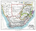
SouthAfrica1885.jpg 3,336 × 2,884; 4.95 MB
-
Southern Africa. 1885.jpg 2,417 × 1,746; 861 KB
-
Tunison's Africa - DPLA - d96822979e08117aec2b052d4f80f9f5.jpg 954 × 1,000; 359 KB
-
Europas Kolonien. 1 1885 (150828037).jpg 3,461 × 5,001; 11.47 MB
-
Europas Kolonien. 1 1885 (150828584).jpg 5,001 × 3,461; 9.99 MB
-
Europas Kolonien. 1 1885 (150829056).jpg 5,053 × 3,632; 9.49 MB
-
Europas Kolonien. 1 1885 (150829116).jpg 4,973 × 7,274; 22.24 MB
-
Europas Kolonien. 2 1885 (143924316).jpg 3,476 × 4,948; 10.13 MB
-
Europas Kolonien. 2 1885 (143924485).jpg 3,429 × 4,948; 9.7 MB


