Category:1884 maps of Kansas
Jump to navigation
Jump to search
States of the United States: California · Connecticut · Delaware · Florida · Georgia · Idaho · Iowa · Kansas · Kentucky · Louisiana · Michigan · Minnesota · Missouri · Montana · New Jersey · New York · North Carolina · North Dakota · Ohio · Oregon · Pennsylvania · South Carolina · South Dakota · Tennessee · Texas · Utah · Virginia · Washington · West Virginia · Wisconsin · Wyoming – Washington, D.C.
| 1882 1883 1884 1885 1886 1887 1888 1889 → |
Subcategories
This category has the following 12 subcategories, out of 12 total.
S
Media in category "1884 maps of Kansas"
The following 18 files are in this category, out of 18 total.
-
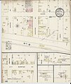 Sanborn Fire Insurance Map from Burrton, Harvey County, Kansas. LOC sanborn02911 001.jpg 6,450 × 7,650; 3.72 MB
-
 Sanborn Fire Insurance Map from Burrton, Harvey County, Kansas. LOC sanborn02911 001.tif 6,450 × 7,650; 141.17 MB
-

-
 Sanborn Fire Insurance Map from Cottonwood Falls, Chase County, Kansas. LOC sanborn02937 001.tif 6,450 × 7,650; 141.17 MB
-
 Sanborn Fire Insurance Map from Dodge City, Ford County, Kansas. LOC sanborn02940 001.jpg 6,450 × 7,650; 3.56 MB
-
 Sanborn Fire Insurance Map from Dodge City, Ford County, Kansas. LOC sanborn02940 001.tif 6,450 × 7,650; 141.17 MB
-
 Sanborn Fire Insurance Map from Kinsley, Edwards County, Kansas. LOC sanborn03002 001.jpg 6,450 × 7,650; 3.63 MB
-
 Sanborn Fire Insurance Map from Kinsley, Edwards County, Kansas. LOC sanborn03002 001.tif 6,450 × 7,650; 141.17 MB
-

-
 Sanborn Fire Insurance Map from Lindsborg, Mcpherson County, Kansas. LOC sanborn03017 001.tif 6,450 × 7,650; 141.17 MB
-
 Sanborn Fire Insurance Map from Russell, Russell County, Kansas. LOC sanborn03068 001.jpg 6,450 × 7,650; 3.54 MB
-
 Sanborn Fire Insurance Map from Russell, Russell County, Kansas. LOC sanborn03068 001.tif 6,450 × 7,650; 141.17 MB
-
 Sanborn Fire Insurance Map from Sedgwick, Harvey County, Kansas. LOC sanborn03079 001.jpg 6,450 × 7,650; 3.65 MB
-
 Sanborn Fire Insurance Map from Sedgwick, Harvey County, Kansas. LOC sanborn03079 001.tif 6,450 × 7,650; 141.17 MB
-

-

-

-
 Sanborn Fire Insurance Map from Yates Center, Woodson County, Kansas. LOC sanborn03119 001.tif 6,450 × 7,650; 141.17 MB


