
Category:1880s maps of Ireland
Media in category "1880s maps of Ireland"
The following 56 files are in this category, out of 56 total.
-
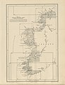
 The earth and its inhabitants (1881) (14782063054).jpg 1,912 × 1,950; 645 KB
-
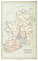
 The earth and its inhabitants (1882) (14586574350).jpg 1,884 × 1,376; 627 KB
-

-

-

-

-

-

-

-

-

-
 MURPHY(1883) p185 Map of Wexford.jpg 1,193 × 1,989; 1.02 MB
-

-

-
 BGS GSI map Kilflynn 1883.jpg 1,013 × 564; 209 KB
-
 MURPHY(1883) p008 Map of Ireland, showing Cromwell's Route.jpg 2,079 × 2,605; 2.54 MB
-
 MURPHY(1883) p123 Map of Drogheda in 1749.jpg 1,355 × 1,977; 1.18 MB
-
 MURPHY(1883) p223 Map of New Ross, c.1680.jpg 2,003 × 1,197; 1.01 MB
-
 MURPHY(1883) p345 Map of Kilkenny.jpg 1,906 × 1,136; 1.01 MB
-
 MURPHY(1883) p371 Map of Clonmel.jpg 2,011 × 1,215; 1.08 MB
-

-
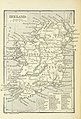
 100 of '(Our own country. Descriptive, historical, pictorial.)' (11175981394).jpg 1,879 × 1,523; 805 KB
-

-
-
 BAGWELL(1885) p 2.168 Ireland about 1570.jpg 1,501 × 2,361; 2.24 MB
-
 BAGWELL(1885) p 1.068 Ireland in 1172.jpg 1,475 × 2,379; 1.92 MB
-
 BAGWELL(1885) p 1.102 Ireland about 1300.jpg 1,485 × 2,373; 2.22 MB
-
 BAGWELL(1885) p 1.159 Ireland about 1500.jpg 1,475 × 2,341; 1.77 MB
-
 BAGWELL(1885) p 1.325 Ireland - Ecclesiastical.jpg 1,477 × 2,343; 1.78 MB
-
 131 of '(Our own country. Descriptive, historical, pictorial.)' (11180297916).jpg 1,070 × 2,263; 766 KB
-
 145 of '(Our own country. Descriptive, historical, pictorial.)' (11176703565).jpg 1,920 × 2,047; 937 KB
-
 217 of '(Our own country. Descriptive, historical, pictorial.)' (11178940473).jpg 1,952 × 1,508; 806 KB
-
 265 of '(Our own country. Descriptive, historical, pictorial.)' (11177411263).jpg 1,928 × 1,560; 859 KB
-
 63 of '(Our own country. Descriptive, historical, pictorial.)' (11181649886).jpg 1,118 × 2,561; 1.1 MB
-
-
-

-

-

-

-

-
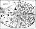 SULLIVAN(1888) p039 Map of the City of Dublin.jpg 2,077 × 1,699; 2.48 MB
-
 16 of 'Ireland- its health resorts and watering places. With maps, etc' (11196566473).jpg 2,789 × 3,294; 1.66 MB
-

-

-

-

-

-
 Admiralty Chart No 2046 Waterford Harbour, Published 1882.jpg 11,126 × 16,238; 70.55 MB
-
 Arbuckle Bros. Coffee Co. (3093827362).jpg 799 × 467; 323 KB
-
 Harper's school geography (1885) (14586866247).jpg 2,484 × 3,286; 1.25 MB
-
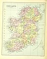
 Ireland Physical map 1880.jpg 4,806 × 5,884; 2.57 MB
-
 Ireland. Transferred from the Orde survey index map, feby 1888 - btv1b530290807.jpg 8,433 × 11,431; 13.26 MB
-
 Lives of Irish Martyrs and Confessors (1880) (14758238136).jpg 2,538 × 3,246; 1.22 MB
-

-
 The earth and its inhabitants (1881) (14804261343).jpg 1,852 × 1,368; 554 KB
_(14782063054).jpg)
_(14586574350).jpg)
.jpg)
.jpg)
.jpg)
.jpg)
.jpg)
.jpg)
.jpg)
_(cropped).jpg)
.jpg)
_p185_Map_of_Wexford.jpg)
%27_(11161008066).jpg)
%27_(11164709964).jpg)

_p008_Map_of_Ireland,_showing_Cromwell%27s_Route.jpg)
_p123_Map_of_Drogheda_in_1749.jpg)
_p223_Map_of_New_Ross,_c.1680.jpg)
_p345_Map_of_Kilkenny.jpg)
_p371_Map_of_Clonmel.jpg)
%27_(11167820205).jpg)
%27_(11175981394).jpg)
%27_(11174619214).jpg)
%27_(11181650913).jpg)
_p_2.168_Ireland_about_1570.jpg)
_p_1.068_Ireland_in_1172.jpg)
_p_1.102_Ireland_about_1300.jpg)
_p_1.159_Ireland_about_1500.jpg)
_p_1.325_Ireland_-_Ecclesiastical.jpg)
%27_(11180297916).jpg)
%27_(11176703565).jpg)
%27_(11178940473).jpg)
%27_(11177411263).jpg)
%27_(11181649886).jpg)
.jpg)
.jpg)
.jpg)
.jpg)
.jpg)
_p039_Map_of_the_City_of_Dublin.jpg)
.jpg)
.jpg)
.jpg)
.jpg)
.jpg)


.jpg)
_(14586866247).jpg)

_(14758238136).jpg)
.jpg)
_(14804261343).jpg)
_Edited_by_E._G._Ravenstein_..._Illustrated,_etc%27_(11191060794).jpg)
._Original_from_British_Library._Digitally_enhanced_by_rawpixel._(50623714617).jpg)