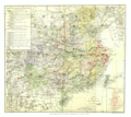
Category:1880s maps of China
Jump to navigation
Jump to search
Subcategories
This category has the following 8 subcategories, out of 8 total.
- 1886 maps of China (9 F)
Media in category "1880s maps of China"
The following 40 files are in this category, out of 40 total.
-
Carte pour suivre l'expédition du Tonkin - btv1b53021157r.jpg 8,815 × 6,737; 8.27 MB
-
Meyers b16 s0872a.jpg 1,600 × 1,294; 2.07 MB
-
A Map of China (China's Spiritual Need and Claims, 1887).png 6,324 × 5,633; 52.7 MB
-
A Map of China (China's Spiritual Need and Claims, 1887).xcf 6,217 × 5,569; 92.34 MB
-
Guangdong quan sheng shui lu yu tu LOC gm71005159.jpg 14,152 × 11,530; 22.07 MB
-
Guangdong quan sheng shui lu yu tu LOC gm71005159.tif 14,152 × 11,530; 466.84 MB
-
Huang chao zhi sheng yu di quan tu. LOC gm71005103.jpg 15,408 × 17,612; 39.49 MB
-
Map of Hong Kong with British Kowloon 1888 24727376.jpg 10,178 × 6,754; 9.22 MB
-
121 - Asie orientale - Géographie historique. Leçons en regard des cartes.jpg 2,073 × 2,723; 1.18 MB
-
Paklung413.jpg 1,361 × 888; 538 KB
-
345 of 'Handbook of Commercial Geography' (11199037383).jpg 2,288 × 1,420; 675 KB
-
1889 China Map by Rand McNally and Company.jpg 1,077 × 1,536; 612 KB
-
Les côtes de la Chine.jpg 6,889 × 4,735; 4.66 MB
-
Liaoning 1882 - Shengjing.jpg 7,119 × 5,771; 4.2 MB
-
Liaoning 1882 Cities - Liaoyang.jpg 6,998 × 5,478; 3.65 MB
-
Liaoning 1882 Cities - Tieling.jpg 6,936 × 5,740; 4.16 MB
-
Liaoning 1882 Cities - Xinmintun.jpg 6,599 × 5,403; 3.84 MB
-
Liaoning 1882 Cities - Yalujiang.jpg 7,009 × 5,769; 3.88 MB
-
Map of Guangdong Province, China, 1889.jpg 3,942 × 2,688; 2.22 MB
-
The Islands of Japan with Corea, Manchooria, and the New Russian Acquisitions.jpg 1,168 × 1,600; 379 KB


