Category:1876 maps of Africa
Jump to navigation
Jump to search
Temperate regions: North America · South America · Africa · Europe · Asia · Oceania – Polar regions: – Other regions:
| ← 1870 1871 1872 1873 1874 1875 1876 1877 1878 1879 → |
Subcategories
This category has the following 2 subcategories, out of 2 total.
Media in category "1876 maps of Africa"
The following 42 files are in this category, out of 42 total.
-
14 of 'Africa unveiled. ... With map and illustrations' (11111778594).jpg 2,748 × 2,500; 1.47 MB
-
Africa - DPLA - 015e2c35310089e67118e85fc16ae615.jpg 1,000 × 778; 265 KB
-
Africa - DPLA - ebc8c13359eb5f5698fb266ac8bb97fe.jpg 1,000 × 741; 250 KB
-
Africa Central - DPLA - a6ea735a3785176a3075ab8da0b1e194.jpg 773 × 1,000; 167 KB
-
Africa; Delta of The Nile; Island of St.Helena NYPL1584675.tiff 5,428 × 6,720; 104.36 MB
-
Afrika - DPLA - 50f99fcb4667eacb0f381905443a0d3d.jpg 1,000 × 898; 238 KB
-
Afrique - DPLA - 5eee10ebe48e666bdad303c6b1f004d1.jpg 825 × 1,000; 281 KB
-
Afrique - Signé E. L. - btv1b531192945.jpg 8,737 × 6,735; 8.57 MB
-
Distribution of Animals - Ethiopian Region.jpg 2,764 × 1,937; 1.46 MB
-
Etat des connaissances sur lAfrique en 1876.jpg 621 × 673; 58 KB
-
Itinéraire de A. Raffray en Abyssinie 1873-1874 - L. Bouffard - btv1b84923006.jpg 4,408 × 6,681; 4.84 MB
-
Life-expectancy,Africa,1876.svg 850 × 691; 13 KB
-
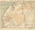
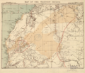
Map of the western Sahara LOC 2005625340.jpg 4,930 × 4,233; 2.59 MB
-
Map of the western Sahara LOC 2005625340.tif 4,930 × 4,233; 59.71 MB
-
Map of the Western Sahara WDL479.png 1,192 × 1,024; 2.1 MB
-
Sahara western 1876 map by Ravenstein.jpg 4,930 × 4,233; 5.67 MB
-
Tanganjika-Loanda.JPG 3,926 × 2,375; 1.25 MB
-
Tanganjika-See.JPG 1,838 × 4,822; 897 KB
-
The geographical distribution of animals (8447947404).jpg 3,120 × 1,997; 1.12 MB
-
Western Sahara 1876.png 746 × 641; 882 KB


