Category:1870s maps of the Balkans
Jump to navigation
Jump to search
English: This category is intended to collect maps from the 1870s that show multiple Balkan countries in one map frame.
Subcategories
This category has the following 7 subcategories, out of 7 total.
B
- 1870s maps of Bulgaria (23 F)
C
- 1870s maps of Croatia (5 F)
G
- 1870s maps of Greece (12 F)
R
S
- 1870s maps of Serbia (9 F)
Media in category "1870s maps of the Balkans"
The following 36 files are in this category, out of 36 total.
-
Turkey in Europe and Greece.jpg 3,800 × 5,000; 3.38 MB
-
19th-century map of the Turkish Empire, Greece and the Caucasus.jpg 13,315 × 10,439; 28.24 MB
-
Greater Serbia, Miloš Milojević (1873).jpg 976 × 717; 371 KB
-
Stieler, Adolf. Das Mittellandische Meer Und Nord-Afrika. 1875 F.jpg 3,365 × 2,409; 2.33 MB
-
Stieler, Adolf. Das Mittellandische Meer Und Nord-Afrika. 1875 FC.jpg 1,979 × 2,409; 1.4 MB
-
1876 - General-Karte von Bosnien, der Hercegovina, von Serbien und Montenegro.jpg 23,376 × 15,604; 94.48 MB
-
The Collegiate Atlas 1876 (82451379).jpg 6,640 × 8,600; 7.06 MB
-
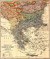
1877 - Ethnological map of European Turkey and Greece.tif 4,210 × 5,059; 50.34 MB
-
26 of 'The Defence of Plevna, 1877. Written by One who took part in it' (11232464913).jpg 2,846 × 2,519; 1.69 MB
-
Edward Stanford 1877 - mistakes.JPG 1,350 × 1,589; 1.05 MB
-
Edward Stanford 1877.jpg 1,350 × 1,287; 1.17 MB
-
1877 - Stanford’s popular map of the seat of the Russo-Turkish War of 1877–78.jpg 8,534 × 6,016; 10.13 MB
-
1877 map - The cross and the crescent- Harper's pictorial map of the seat of the war in the east.png 10,028 × 7,036; 198.78 MB
-
8 of 'Turkey in Europe ... With two maps' (11118101504).jpg 5,172 × 4,015; 5.57 MB
-
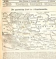
Der gegenwaertige Stand des Okkupationswerkes.jpg 928 × 980; 227 KB
-
Harper's Map of Danube.jpg 660 × 628; 190 KB
-
Map of Turkey in Europe. Illustrating The Berlin Congress Treaty, July 1878.jpg 9,118 × 12,952; 30.36 MB
-
Map to illustrate the Treaty of Berlin.png 5,264 × 6,755; 39.79 MB
-
SouthEast Europe 1878.jpg 1,739 × 1,224; 2.14 MB
-
Changes in Turkey-in-Europe 1856 to 1878.png 809 × 1,314; 1.6 MB
-
A Synvet 1877.jpg 1,339 × 1,381; 857 KB
-
Balkan 1870 Brockhaus.jpg 5,156 × 4,312; 5.72 MB
-
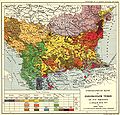
Balkans-ethnic (1877).jpg 2,020 × 2,084; 1.14 MB
-
CarlSaxET1877.jpg 3,100 × 2,968; 7.57 MB
-
S-Stefano-Berlin-1878.png 897 × 1,608; 1.97 MB
-
Südosteuropa BV042746389.jpg 6,326 × 4,432; 5.59 MB
-
Turkey Grerce 1870 Brockhaus.jpg 2,800 × 3,961; 3.13 MB


