Category:1870s maps of New Zealand
Jump to navigation
Jump to search
Countries of Oceania: Australia · New Zealand · Solomon Islands
Other areas: Hawaii – Partly: Indonesia
Other areas: Hawaii – Partly: Indonesia

Media in category "1870s maps of New Zealand"
The following 38 files are in this category, out of 38 total.
-

-
 1873 Francis Hick Subdivision.jpg 1,634 × 1,564; 338 KB
-
 1873 Karamū Junction Reserve.jpg 2,614 × 1,504; 292 KB
-
 1873 Plan of the Township of Hastings - Francis Hicks.jpg 1,600 × 1,006; 275 KB
-
 1873 Plan of the Township of Hastings.jpg 800 × 503; 112 KB
-

-

-
-

-

-
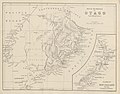
 ALEXANDER(1873) p028 MAP OF PART OF THE NORTH ISLAND OF NEW ZEALAND.jpg 2,321 × 2,963; 3.25 MB
-
 ALEXANDER(1873) p075 1863-07-17, KOHEROA RIDGES.jpg 2,269 × 1,423; 1.33 MB
-
 ALEXANDER(1873) p095 1863-11-01, MERI-MERI.jpg 2,271 × 1,395; 1.51 MB
-
 ALEXANDER(1873) p169 1864-02-22, RANGIAWHIA.jpg 2,251 × 1,379; 1.4 MB
-
 ALEXANDER(1873) p222 THE GATE PAH.jpg 1,351 × 2,263; 1.21 MB
-

-
-

-
 ALEXANDER(1873) p051 1864-03-25, KAITAKE.jpg 2,277 × 1,475; 1.73 MB
-
 ALEXANDER(1873) p133 1863-11-20, RANG IRIRI.jpg 1,067 × 1,697; 824 KB
-
 ALEXANDER(1873) p192 1863-06-04, KATIKARA RIVER.jpg 2,253 × 1,381; 1.02 MB
-
 ALEXANDER(1873) p204 1864-04-02, ORAKAU.jpg 2,233 × 1,389; 1.41 MB
-
 ALEXANDER(1873) p254 1864-06-21, TE RANGI.jpg 1,357 × 2,269; 1.15 MB
-
 ALEXANDER(1873) p294 1865-01-25, NUKUMARU.jpg 2,237 × 1,382; 1.26 MB
-
-
-

-
 1876 Heretaunga Block Rochfort Map.jpg 8,728 × 7,581; 18.11 MB
-
-
 The Collegiate Atlas 1876 (82452648).jpg 6,672 × 8,470; 7.89 MB
-
 Goodwins Hall.jpg 828 × 1,200; 106 KB
-
-

-
 1879 Hastings East Town Plan of Thomas Tanner.jpg 2,000 × 1,426; 424 KB
-

-

-
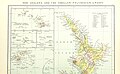
 Map of the north part of the county of Westland New Zealand (1875).jpg 1,349 × 3,000; 568 KB
-
 Mohaka, Waikaremoana and Poverty Bay, 1870 (28724159310).jpg 4,000 × 2,367; 7.65 MB
%27_(11098314714).jpg)


.jpg)
.jpg)
.jpg)
.jpg)
.jpg)
_p028_MAP_OF_PART_OF_THE_NORTH_ISLAND_OF_NEW_ZEALAND.jpg)
_p075_1863-07-17,_KOHEROA_RIDGES.jpg)
_p095_1863-11-01,_MERI-MERI.jpg)
_p169_1864-02-22,_RANGIAWHIA.jpg)
_p222_THE_GATE_PAH.jpg)
.jpg)
.jpg)
.jpg)
_p051_1864-03-25,_KAITAKE.jpg)
_p133_1863-11-20,_RANG_IRIRI.jpg)
_p192_1863-06-04,_KATIKARA_RIVER.jpg)
_p204_1864-04-02,_ORAKAU.jpg)
_p254_1864-06-21,_TE_RANGI.jpg)
_p294_1865-01-25,_NUKUMARU.jpg)
%27_(11105357395).jpg)
%27_(11110296744).jpg)
.jpg)


.jpg)

.jpg)
.jpg)

.jpg)
.jpg)
.jpg)
.jpg)