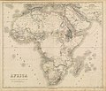
Category:1868 maps of Africa
Jump to navigation
Jump to search
Temperate regions: North America · South America · Africa · Europe · Asia · – Polar regions: – Other regions:
| ← 1860 1861 1862 1863 1864 1865 1866 1867 1868 1869 → |
Media in category "1868 maps of Africa"
The following 15 files are in this category, out of 15 total.
-
(1868) MAP OF THE WEST COAST OF AFRICA, by Africanus Horton, Sierra Leone.jpg 3,206 × 4,129; 6.27 MB
-
(1868) Map of Liberia. West Africa.jpg 1,811 × 1,284; 1.43 MB
-
Africa - DPLA - c179396c97d57e9061f8867575d28dfc.jpg 1,000 × 858; 203 KB
-
Life-expectancy,Africa,1868.svg 850 × 691; 13 KB


