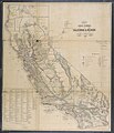
Category:1866 maps of California
Jump to navigation
Jump to search
States of the United States: California · Idaho · Kentucky · Louisiana · Michigan · Montana · New Mexico · New York · Oregon · Pennsylvania · Utah · Virginia
Media in category "1866 maps of California"
The following 10 files are in this category, out of 10 total.
-
DWIN pg096 THE PENINSULA OF SAN FRANCISCO.jpg 1,489 × 1,989; 953 KB
-
1866 cal grants survey.jpg 1,500 × 1,746; 378 KB
-
1866 Mitchell Map of California - Geographicus - California-mitchell-1866.jpg 2,766 × 3,500; 3.4 MB
-
1866 Northern California Map.jpg 3,000 × 2,955; 4.19 MB
-
Map Comprising Parts of California, Oregon and Idaho - NARA - 93193179.jpg 10,800 × 10,451; 6.08 MB
-
Official map of Amador County, California. - approved by the Board of Supervisors LOC 2012590176.jpg 12,214 × 7,891; 13.82 MB
-
Official map of Amador County, California. - approved by the Board of Supervisors LOC 2012590176.tif 12,214 × 7,891; 275.75 MB


