Category:1861 maps of the United States
Jump to navigation
Jump to search
Countries of the Americas: Canada · United States of America
States of the United States: California · Delaware · Florida · Georgia · Illinois · Iowa · Louisiana · Maryland · Michigan · Nevada · North Carolina · Ohio · South Carolina · Texas · Utah · Virginia · West Virginia – Washington, D.C.
Subcategories
This category has the following 19 subcategories, out of 19 total.
C
- 1861 maps of California (5 F)
D
- 1861 maps of Delaware (2 F)
F
- 1861 maps of Florida (4 F)
I
- 1861 maps of Illinois (15 F)
- 1861 maps of Iowa (2 F)
L
- 1861 maps of Louisiana (3 F)
M
- 1861 maps of Michigan (2 F)
N
O
- 1861 maps of Ohio (9 F)
S
- 1861 maps of South Carolina (11 F)
T
- 1861 maps of Texas (4 F)
U
- 1861 maps of Utah (1 F)
V
W
- 1861 maps of West Virginia (10 F)
Media in category "1861 maps of the United States"
The following 96 files are in this category, out of 96 total.
-
1860-61 Secession in Appalachia by County.jpg 1,887 × 2,393; 1.82 MB
-
Johnston's map of the United States of North America (NYPL b20643931-5564119).jpg 8,928 × 6,986; 58.21 MB
-
Johnston's map of the United States of North America (NYPL b20643931-5564119).tiff 10,328 × 7,760, 2 pages; 229.61 MB
-
Battles on Fairfax and Prince William border.jpg 2,000 × 1,672; 3.53 MB
-
Cgs05193 (9716272729).jpg 3,604 × 1,627; 3.8 MB
-
Colorado Territory in 1861, showing acquisitions.png 834 × 530; 614 KB
-
Colton's Map of the Southern States - NARA - 77452215 (page 1).jpg 8,672 × 11,978; 11.03 MB
-
Colton's Map of the Southern States - NARA - 77452215 (page 2).jpg 8,792 × 11,987; 11.91 MB
-
Colton's United States shewing the military stations, forts, &c LOC 99447014.jpg 5,551 × 4,822; 5.82 MB
-
Colton's United States shewing the military stations, forts, &c LOC 99447014.tif 5,551 × 4,822; 76.58 MB
-
Complete map of the rail roads and water courses, in the United States & Canada. LOC 98688331.tif 8,304 × 6,976; 165.74 MB
-
Lloyd's Map of the Southern States 1861 UTA.jpg 4,568 × 3,320; 11 MB
-
Lloyd's American railroad map, showing the whole seat of the war. LOC 99447034.jpg 14,584 × 11,481; 27.47 MB
-
Lloyd's American railroad map, showing the whole seat of the war. LOC 99447034.tif 14,584 × 11,481; 479.05 MB
-
Lloyd's American railroad map. LOC gm70005368.jpg 14,720 × 11,520; 25.8 MB
-
Lloyd's American railroad map. LOC gm70005368.tif 14,720 × 11,520; 485.16 MB
-
Lloyd's new military map of the border & southern states; drawn by Edward S. Hall. LOC 98688407.jpg 12,907 × 9,555; 21.05 MB
-
Lloyds American railroad map (8347223966).jpg 800 × 623; 143 KB
-
Lloyds American railroad map (9141774709).jpg 799 × 622; 150 KB
-
Louisiana and Mississippi 1861.jpg 7,352 × 5,600; 5.13 MB
-
Map of Alabama highlighting the 'Republic of Winston'.svg 3,379 × 5,346; 94 KB
-
Map of American Civil War in 1861-es.svg 3,998 × 2,011; 974 KB
-
Map of American Civil War in 1861.svg 4,110 × 2,142; 283 KB
-
Goldthwait's map of the United States & Canada (NYPL b19605149-5686958).tiff 7,760 × 10,328, 2 pages; 229.61 MB
-
Goldthwait's map of the United States & Canada (NYPL b19605149-5686959).tiff 7,760 × 10,328, 2 pages; 229.61 MB
-
Colton's United States shewing the military stations, forts, & c (NYPL b20643933-5564110).jpg 8,245 × 7,080; 54.62 MB
-
G. Woolworth Colton's map of the country 500 miles around Cairo (NYPL b20643935-5564109).jpg 6,657 × 9,236; 62.93 MB
-
G. Woolworth Colton's map of the country 500 miles around Cairo (NYPL b20643935-5564109).tiff 7,760 × 10,328, 2 pages; 229.61 MB
-
Map showing the comparitive area of the Northern and Southern States, east of the Rocky Mountains, 1861 (NYPL b20643937-5686998).tiff 10,328 × 7,760, 2 pages; 229.61 MB
-
G. Woolworth Colton's new guide map of the United States & Canada, with railroads, counties, etc (NYPL b20643941-5686960).tiff 7,760 × 10,328, 2 pages; 229.61 MB
-
G. Woolworth Colton's new guide map of the United States & Canada, with railroads, counties, etc (NYPL b20643941-5686961).tiff 7,760 × 10,328, 2 pages; 229.61 MB
-
Phelps & Watsons new map of the United States (9473842756).jpg 800 × 788; 174 KB
-
Preliminary chart of the northwestern part of the Gulf of Mexico. Unfinished proof. LOC 99447059.jpg 21,114 × 9,826; 21.28 MB
-
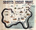
Scott's great snake. Entered according to Act of Congress in the year 1861 LOC 99447020.jpg 6,424 × 4,871; 4.02 MB
-
Scott-anaconda.jpg 5,248 × 4,382; 4.16 MB
-
SlavePopulationUS1860.jpg 10,503 × 8,380; 15.5 MB
-
Stanford's map of the seat of war in America. LOC 99447054.jpg 7,016 × 8,330; 10.54 MB
-
Stanford's map of the seat of war in America. LOC 99447054.tif 7,016 × 8,330; 167.21 MB
-
Stanford's railway & county Map of the United States and Territories - btv1b53233197z.jpg 17,322 × 11,460; 34.33 MB
-
Thayer's statistical and military map of the middle and southern states. LOC 99447056.jpg 9,144 × 6,840; 14.15 MB
-
Thayer's statistical and military map of the middle and southern states. LOC 99447056.tif 9,144 × 6,840; 178.94 MB
-
United States 1861-03-1861-08.png 1,000 × 677; 114 KB
-
United States 1861-08-1862.png 1,000 × 677; 118 KB
-
Western border states LOC 99447025.jpg 8,487 × 11,377; 16.78 MB
-
Western border states LOC 99447025.tif 8,487 × 11,377; 276.25 MB
-
Wpdms washington dakota territories 1861.idx.png 232 × 168; 10 KB


