Category:1860s maps of South Holland
Jump to navigation
Jump to search
Provinces of the Netherlands: North Holland · South Holland ·
Media in category "1860s maps of South Holland"
The following 200 files are in this category, out of 240 total.
(previous page) (next page)-
Zuid Holland 1865.png 2,100 × 1,513; 404 KB
-
Provzuidholland.gif 2,100 × 1,513; 441 KB
-
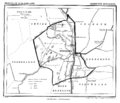
Maasdam.gif 1,600 × 1,371; 164 KB
-
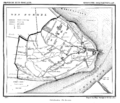
Moercapelle.gif 1,600 × 1,414; 150 KB
-
Netherlands, Geervliet, map, around 1865-1870.jpg 2,560 × 2,135; 1.69 MB
-
Alkemade 1865.gif 1,600 × 1,334; 241 KB
-
Delfshaven 1865.png 1,600 × 1,385; 208 KB
-
Delfshaven.gif 1,600 × 1,385; 232 KB
-
Delft, No 2 Stad, Gemeente-Atlas van Nederland, 1865.jpg 2,543 × 2,146; 1.57 MB
-
Goudswaard 1865.png 1,300 × 1,646; 285 KB
-
Herkingen, Gemeenteatlas van Nederland.jpg 2,712 × 2,091; 1.1 MB
-
Hillegom 1865.gif 1,600 × 1,349; 182 KB
-
IJsselmonde 1865.png 1,599 × 1,396; 193 KB
-
Katendrecht 1865.png 1,600 × 1,360; 169 KB
-
Katwijk 1865.png 1,600 × 1,355; 181 KB
-
Kethel Spaland 1865.png 1,600 × 1,364; 193 KB
-
Koudekerk 1865.png 1,600 × 1,359; 141 KB
-
Lisse 1865.png 1,300 × 1,638; 221 KB
-
Melissant, Gemeenteatlas van Nederland.jpg 2,123 × 2,640; 1.12 MB
-
Moercapelle 1865.png 1,600 × 1,414; 132 KB
-
Monster 1865.png 1,600 × 1,409; 190 KB
-
Monster.gif 1,600 × 1,409; 208 KB
-
Netherlands, Aarlanderveen, map of 1865.jpg 2,000 × 1,652; 1.17 MB
-
Netherlands, Abbenbroek, map of 1867.jpg 2,576 × 2,127; 1.6 MB
-
Netherlands, Alkemade, map of 1865.PNG 2,423 × 1,977; 7.33 MB
-
Netherlands, Stompwijk, map, around 1865-1870.jpg 1,952 × 2,400; 1.91 MB
-
Nieuwenhoorn 1865.png 1,300 × 1,659; 204 KB
-
Pernis 1865.png 1,600 × 1,354; 183 KB
-
Piershil 1865.png 1,600 × 1,403; 141 KB
-
Rijnsaterwoude, Gemeenteatlas van Nederland.jpg 2,621 × 2,023; 1.01 MB
-
Rotterdam 1865 2.png 1,900 × 1,379; 623 KB
-
Rotterdam 1865.png 1,300 × 1,578; 347 KB
-
Rotterdam No 2, stad, Gemeente-Atlas van Nederland, 1865.jpg 2,527 × 1,834; 1.45 MB
-
Rotterdam, Gemeente-Atlas van Nederland, 1865.jpg 2,046 × 2,532; 1.32 MB
-
Rotterdamstad.gif 1,900 × 1,379; 709 KB
-
Schiebroek 1865.png 1,300 × 1,631; 123 KB
-
Schoonhoven 1865.png 1,334 × 1,721; 191 KB
-
Stellendam, Gemeenteatlas van Nederland.jpg 2,601 × 2,114; 1.28 MB
-
Valkenburg - South Holland, Gemeenteatlas van Nederland.jpg 2,664 × 2,087; 983 KB
-
Voorschoten 1865.png 1,332 × 1,640; 200 KB
-
Willige Langerak 1865.png 1,599 × 1,378; 217 KB
-
Zevenhuizen 1865.png 1,299 × 1,638; 186 KB
-
Zuidbeijerland 1865.png 1,627 × 1,428; 265 KB
-
Netherlands, Peursum, map, around 1865-1870.PNG 2,396 × 2,004; 4.7 MB
-
Sandelingenambacht 1866.jpg 2,698 × 2,384; 778 KB
-
Den Bommel 1866.png 1,300 × 1,655; 236 KB
-
Gouda 1866.png 1,600 × 1,411; 413 KB
-
Gouda2 1866.png 1,600 × 1,405; 162 KB
-
Gouderak 1866.png 1,600 × 1,370; 151 KB
-
Groot Ammers 1866.png 1,300 × 1,666; 163 KB
-
Hei-Boeicop 1866.png 1,600 × 1,381; 135 KB
-
Hekelingen 1866.png 1,600 × 1,381; 177 KB
-
Hekelingen en Vriesland - 1866.png 1,600 × 1,381; 420 KB
-
Hellevoetsluis 1866.png 1,600 × 1,370; 157 KB
-
HendrikIdoAmbacht 1866.png 1,600 × 1,351; 194 KB
-
Heukelum, Gemeenteatlas van Nederland.jpg 2,584 × 2,075; 1,022 KB
-
Hofvandelft.gif 1,600 × 1,381; 210 KB
-
Hofvandelft2.gif 1,578 × 1,344; 256 KB
-
Hoogvliet 1866.png 1,600 × 1,396; 211 KB
-
Kaart gemeente Alphen.gif 2,288 × 1,962; 109 KB
-
Kedichem 1866.png 1,600 × 1,394; 151 KB
-
Lange Ruige Weide 1866.png 1,600 × 1,401; 131 KB
-
Langerak ZH 1866.png 1,608 × 1,393; 157 KB
-
Leerbroek 1866.png 1,600 × 1,369; 139 KB
-
Leerdam 1866.png 1,600 × 1,410; 163 KB
-
Lekkerkerk 1866.png 1,600 × 1,410; 169 KB
-
Lexmond 1866.png 1,300 × 1,643; 194 KB
-
Meerkerk 1866.png 1,600 × 1,370; 138 KB
-
Middelharnis 1866.png 1,600 × 1,360; 201 KB
-
Mijnsheerenland, Gemeenteatlas van Nederland.jpg 2,638 × 2,104; 1.16 MB
-
Nieuw-Beijerland, Gemeenteatlas van Nederland.jpg 2,612 × 2,119; 1.11 MB
-
NieuwHellevoet 1866.png 1,600 × 1,388; 230 KB
-
Nieuwpoort 1866.png 1,300 × 1,654; 143 KB
-
Nieuwveen 1866.png 1,300 × 1,120; 103 KB
-
Ooltgensplaat 1866.png 1,600 × 1,368; 264 KB
-
Oostvoorne 1866.png 1,600 × 1,358; 282 KB
-
Oud-Beijerland 1866.png 1,300 × 1,649; 205 KB
-
Oude Tonge 1866.png 1,600 × 1,366; 220 KB
-
Papendrecht 1866.png 1,600 × 1,388; 188 KB
-
Rhoon 1866.png 1,381 × 1,188; 1.35 MB
-
Rockanje 1866.png 1,600 × 1,369; 256 KB
-
Schipluiden.gif 1,600 × 1,360; 176 KB
-
Sommelsdijk 1866.png 1,300 × 1,600; 242 KB
-
Stadharingvliet 1866.png 1,599 × 1,385; 257 KB
-
Stompwijk 1866.png 1,299 × 1,618; 172 KB
-
Ter Aar 1866.png 1,600 × 1,373; 199 KB
-
Tienhoven 1866.png 1,299 × 1,655; 134 KB
-
Vlaardingerambacht 1866.png 1,299 × 1,624; 219 KB
-
Voorburg 1866.png 1,599 × 1,383; 182 KB
-
Waarder 1866.png 1,599 × 1,349; 144 KB
-
Westmaas.gif 1,599 × 1,359; 151 KB
-
Zevenhoven 1866.png 1,599 × 1,380; 161 KB
-
Kaart Zevenhoven 1866.jpg 1,545 × 1,332; 728 KB
-
Netherlands, Zuidland, map of 1866.jpg 2,549 × 2,074; 1.74 MB
-
Berkel en Rodenrijs, Gemeenteatlas van Nederland.jpg 2,119 × 2,636; 1,024 KB
-
Overschie 1867.png 1,300 × 1,637; 207 KB
-
Overschie.gif 1,300 × 1,637; 224 KB
-
's-Gravendeel, Gemeenteatlas van Nederland.jpg 2,111 × 2,664; 1.24 MB
-
Bleiswijk, Gemeenteatlas van Nederland.jpg 2,091 × 2,640; 1.12 MB
-
Boskoop, Gemeenteatlas van Nederland.jpg 2,504 × 2,055; 835 KB
-
Brandwijk, Gemeenteatlas van Nederland.jpg 2,528 × 2,107; 1.02 MB
-
Brielle, Gemeenteatlas van Nederland.jpg 2,572 × 2,127; 1.1 MB
-
Broek, Thuil en 't Weegje, Gemeenteatlas van Nederland.jpg 2,768 × 2,063; 1.04 MB
-
Charlois 1867.png 1,600 × 1,343; 202 KB
-
Charlois, Gemeenteatlas van Nederland.jpg 2,636 × 2,112; 1.1 MB
-
Dirksland, Gemeenteatlas van Nederland.jpg 2,680 × 2,087; 1.06 MB
-
Dubbeldam 1867.png 1,600 × 1,365; 362 KB
-
Giessen-Nieuwkerk, Gemeenteatlas van Nederland.jpg 2,600 × 2,115; 1.03 MB
-
Giessendam 1867.png 1,600 × 1,417; 198 KB
-
Groote Lindt 1867.png 1,600 × 1,381; 187 KB
-
Hagestein, Gemeenteatlas van Nederland.jpg 2,720 × 2,143; 1.08 MB
-
Hardinxveld 1867.png 1,600 × 1,357; 252 KB
-
Hazerswoude 1867.png 1,600 × 1,396; 187 KB
-
Heerjansdam 1867.png 1,600 × 1,359; 182 KB
-
Hillegersberg 1867.png 1,600 × 1,346; 280 KB
-
Kaart uit gemeente atlas - Kuiper - Wassenaar - 20084731 - RCE.jpg 2,111 × 2,898; 1.72 MB
-
Klaaswaal, Gemeenteatlas van Nederland.jpg 2,545 × 2,123; 1.06 MB
-
Kralingen 1867.png 1,300 × 1,681; 306 KB
-
Krimpen 1867.png 1,600 × 1,364; 155 KB
-
Krimpen IJssel 1867.gif 1,600 × 1,371; 174 KB
-
Leiderdorp 1867.png 1,600 × 1,396; 193 KB
-
Maasland 1867.png 1,300 × 1,665; 221 KB
-
Maassluis 1867.png 1,600 × 1,415; 201 KB
-
Moordrecht, Gemeenteatlas van Nederland.jpg 2,576 × 2,087; 1,020 KB
-
Naaldwijk 1867.png 1,300 × 1,660; 206 KB
-
Netherlands, Heenvliet, map of 1867.jpg 2,508 × 2,071; 1.61 MB
-
Nieuw-Lekkerland 1867.png 1,600 × 1,365; 176 KB
-
Nieuwe-Tonge, Gemeenteatlas van Nederland.jpg 2,624 × 2,103; 1.08 MB
-
Nieuwerkerk 1867.png 1,300 × 1,636; 180 KB
-
Nieuwerkerk.gif 1,300 × 1,636; 217 KB
-
Oegstgeest 1867.png 1,500 × 1,359; 207 KB
-
Oost en West Barendrecht, Gemeenteatlas van Nederland.jpg 2,620 × 2,123; 1.13 MB
-
Oud-Alblas, Gemeenteatlas van Nederland.jpg 2,596 × 2,103; 975 KB
-
Ouderkerk 1867.png 1,300 × 1,666; 151 KB
-
Oudshoorn, Gemeenteatlas van Nederland.jpg 2,680 × 2,135; 1.1 MB
-
Poortugaal, Gemeenteatlas van Nederland.jpg 2,548 × 2,099; 1.05 MB
-
Puttershoek, Gemeenteatlas van Nederland.jpg 2,657 × 2,082; 1.04 MB
-
Ridderkerk 1867.png 1,300 × 1,624; 216 KB
-
Ridderkerk Strevelshoek Rijsoord 1867.png 1,300 × 1,624; 489 KB
-
Rietveld, Gemeenteatlas van Nederland.jpg 2,588 × 2,095; 975 KB
-
Rijswijk ZH 1867.png 1,600 × 1,368; 191 KB
-
Rozenburg 1867.gif 1,600 × 1,396; 245 KB
-
Rozenburg 1867.png 1,600 × 1,396; 222 KB
-
S'Gravenhage (1867, Gemeente Atlas) The Hague, Netherlands.jpg 2,660 × 2,063; 2.24 MB
-
Sassenheim 1867.png 1,628 × 1,437; 241 KB
-
Schelluinen, Gemeenteatlas van Nederland.jpg 2,135 × 2,668; 1.05 MB
-
Schipluiden 1867.png 1,600 × 1,360; 161 KB
-
Situatie kaart - Vlaardingen - 20376681 - RCE.jpg 1,972 × 2,706; 1.53 MB
-
Sluipwijk 1867.png 1,600 × 1,342; 186 KB
-
Spijkenisse 1867.png 1,299 × 1,682; 243 KB
-
Streefkerk 1867.png 1,599 × 1,413; 173 KB
-
Strijen 1867.png 1,599 × 1,363; 289 KB
-
Veur 1867.png 1,599 × 1,367; 139 KB
-
Vier Polders 1867.png 1,599 × 1,347; 184 KB
-
Vlaardingen 1867.png 1,299 × 1,595; 189 KB
-
Voorhout 1867.png 1,599 × 1,371; 183 KB
-
Warmond 1867.png 1,599 × 1,362; 210 KB
-
Wassenaar - Gemeente Atlas van Nederland.jpg 2,502 × 3,834; 2.99 MB
-
Wassenaar 1867.png 1,332 × 1,981; 424 KB
-
Wijngaarden, Gemeenteatlas van Nederland.jpg 2,628 × 2,129; 1.04 MB
-
Zoeterwoude 1867.png 1,299 × 1,641; 227 KB
-
Zoeterwoude1867.png 600 × 781; 550 KB
-
Zwammerdam, Gemeenteatlas van Nederland.jpg 2,107 × 2,604; 1.12 MB
-
Zwartewaal 1867.png 1,599 × 1,365; 195 KB
-
Zwijndrecht 1867.png 1,299 × 1,602; 216 KB
-
Netherlands, Leiderdorp, map of 1867.png 2,448 × 2,048; 7.52 MB
-
Netherlands, Noordeloos, map of 1867.JPG 1,960 × 2,484; 769 KB
-
Netherlands, Oudenhoorn, map of 1867.jpg 2,580 × 2,095; 1.63 MB
-
Kaart Spijkenisse en Braband 1867 cropped.jpg 825 × 829; 271 KB
-
Netherlands, Veur, map of 1867.jpg 2,340 × 1,996; 1.79 MB
-
Netherlands, Voorburg, map of 1867.jpg 2,356 × 1,972; 1.71 MB
-
Netherlands, Woubrugge, map of 1867.jpg 2,336 × 1,980; 1.82 MB
-
Netherlands, Zoeterwoude, map of 1867.jpg 2,053 × 2,534; 2.35 MB
-
Benthuizen.gif 1,300 × 1,637; 134 KB
-
Berkenwoude, Gemeenteatlas van Nederland.jpg 2,115 × 2,608; 1.08 MB
-
Delft 1865.png 1,600 × 1,387; 176 KB
-
Delier.gif 1,600 × 1,370; 131 KB
-
Den Haag 1868.png 1,800 × 1,254; 379 KB
-
Dordrecht 1868.png 1,600 × 1,272; 395 KB
-
Dordrecht stad, Gemeenteatlas van Nederland.jpg 2,720 × 2,075; 1.76 MB
-
Dordrecht, Gemeenteatlas van Nederland.jpg 2,660 × 2,139; 1.23 MB
-
Gravesande 1868.png 1,300 × 1,627; 320 KB
-
Haastrecht 1868.png 1,600 × 1,358; 179 KB
-
Hoogblokland, Gemeenteatlas van Nederland.jpg 2,568 × 2,072; 1,006 KB
-
Kethel.gif 1,600 × 1,364; 213 KB
-
Leiden 1868.png 1,600 × 1,333; 295 KB
-
Loosduinen.gif 1,300 × 1,668; 292 KB
-
Nieuwkoop 1868.png 1,600 × 1,367; 202 KB
-
Nieuwland 1868.png 1,600 × 1,366; 138 KB
-
Noord Waddinxveen 1868.png 1,599 × 1,400; 148 KB
-
Noordwijk 1868.png 1,300 × 1,673; 237 KB
-
Noordwijkerhout 1868.png 1,300 × 1,669; 222 KB
-
Ouddorp, Gemeenteatlas van Nederland.jpg 2,576 × 2,071; 1.39 MB
-
Reeuwijk 1868.png 1,300 × 1,653; 176 KB
-
Schoonrewoerd 1868.png 1,628 × 1,412; 159 KB
-
Stein 1868.png 1,599 × 1,357; 153 KB
-
Stein Vrijhoef 1868.png 1,599 × 1,357; 346 KB
-
Stolwijk 1868.png 1,599 × 1,401; 154 KB
-
Vlist 1868.png 1,599 × 1,387; 124 KB
-
Wateringen 1868.png 1,599 × 1,354; 129 KB


