Category:1860s maps of Hesse
Jump to navigation
Jump to search
Federal states of Germany:
Media in category "1860s maps of Hesse"
The following 6 files are in this category, out of 6 total.
-
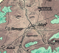
Adorf Map 1866.png 545 × 495; 635 KB
-
Grundriss Gnade Gottes Stangenwage Bergmannsglück Haus Nassau.png 1,418 × 1,088; 227 KB
-
Lageplan des Brandplatzes und der Umgebung zu Gießen.jpg 12,000 × 2,514; 8.2 MB
-
Kurhessen und Nassau.jpg 1,963 × 2,758; 1.72 MB


