
Category:1860s maps of Denmark
Media in category "1860s maps of Denmark"
The following 27 files are in this category, out of 27 total.
-

-

-

-

-
 1862 Stieler Map of Denmark - Geographicus - Danemark-perthes-1862.jpg 3,068 × 2,551; 1.3 MB
-
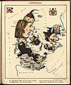
 Le Tour du monde-05-p083.jpg 1,155 × 793; 257 KB
-
 Map of Denmark (NYPL b13663520-1510828).jpg 1,105 × 1,777; 768 KB
-
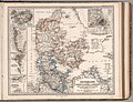
 Meyers b5 s0232 b1.png 381 × 650; 179 KB
-
 61 of 'Invasion du Danemark en 1864' (11069418416).jpg 1,494 × 3,951; 1.12 MB
-
 Auguste Henri Dufour, Danemark avec le midi de la Suède (FL155328926 2573128).jpg 7,773 × 6,437; 56.44 MB
-

-
 Johnson, A.J. Europe. 1864.F.Denmark.jpg 614 × 544; 121 KB
-
 1865 Johnson Map of Sweden, Norway and Denmark - Geographicus - SwedenDenmark-j-65.jpg 4,000 × 2,958; 3.19 MB
-
-

-

-
 Denmark (8249904483).jpg 1,677 × 2,000; 2.94 MB
-

-

-
 8bTondern1864.jpg 2,858 × 2,198; 7.66 MB
-
 Espergærde 1860.png 433 × 263; 223 KB
-
 Gilleleje 1860.png 894 × 645; 1.05 MB
-
 Hornbæk 1860.png 640 × 442; 569 KB
-
 Le Tour du monde-05-p083.png 1,548 × 1,048; 1.01 MB
-
 Nyrup Hegn 1862-1878.png 1,865 × 2,956; 9.58 MB
-
 Situationskarte der Befestigungen von Düppel (1864).jpg 351 × 611; 96 KB
-
 Stieler 1867 Atlas page Danmark with insets.jpg 9,804 × 7,522; 25.66 MB
._(Mit_6_Pl%C3%A4nen.)%27_(11070297435).jpg)
.jpg)
._(Mit_6_Pl%C3%A4nen.)%27_(11068560335).jpg)


.jpg)

.jpg)


_..._Med_253_Illustrationer_i_Tr%C3%A6snit%27_(11076480933).jpg)
%27_(11242405083).jpg)
.jpg)
_..._Med_253_Illustrationer_i_Tr%C3%A6snit%27_(11075563205).jpg)
_..._Med_253_Illustrationer_i_Tr%C3%A6snit%27_(11083853694).jpg)


.jpg)

.jpg)