Category:1852 United States gubernatorial election maps
Jump to navigation
Jump to search
Media in category "1852 United States gubernatorial election maps"
The following 10 files are in this category, out of 10 total.
-
1852 Arkansas gubernatorial election results map by county.svg 810 × 709; 664 KB
-
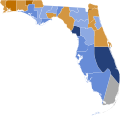
1852 Florida Governor.png 1,200 × 1,064; 29 KB
-
1852 Florida gubernatorial election results map by county.svg 800 × 769; 1.8 MB
-
1852 Louisiana gubernatorial election results map by parish.svg 800 × 729; 1.85 MB
-
1852 Maine gubernatorial election results map by county.svg 800 × 1,220; 3.28 MB
-
1852 Michigan gubernatorial election results map by county.svg 800 × 913; 1.41 MB
-
1852 New York gubernatorial election results map by county.svg 800 × 611; 1,011 KB
-
1852 North Carolina gubernatorial election results map by county.svg 800 × 305; 1.96 MB
-
ELECTION DU GOUVERNEUR EN 1852 DANS L'ILLINOIS.png 186 × 320; 4 KB
-
Florida 1852 Governor Election County Map Results.png 1,280 × 1,280; 127 KB


