Category:1850s maps of the Caucasus
Jump to navigation
Jump to search
Subcategories
This category has the following 4 subcategories, out of 4 total.
A
- 1850s maps of Azerbaijan (2 F)
G
Media in category "1850s maps of the Caucasus"
The following 44 files are in this category, out of 44 total.
-
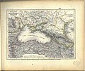
Meyer‘s Zeitungsatlas 078 – Küstenländer des Schwarzen Meeres.jpg 7,365 × 6,224; 16.74 MB
-
Karte des Schwarzen Meeres.jpg 5,709 × 4,732; 8.07 MB
-
Martin, R.M.; Tallis, J. & F. Turkey in Asia. 1851 (B).jpg 1,506 × 1,114; 456 KB
-
Black Sea and the Caucasus, 1852 г..jpg 2,975 × 2,165; 9.35 MB
-
Die Asiatische Türkei, die Kaukasusländer und West-Persien von H. Kiepert.jpg 8,277 × 6,713; 20.61 MB
-
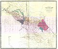
Дорожная карта Кавказского края 1853 г. (186(4).jpg 19,070 × 16,053; 12 MB
-
(BL) THE CAUCASUS (Map).jpg 2,943 × 2,299; 3.56 MB
-
August von Haxthausen. Transcaucasia. The Caucasus map. A.jpg 1,582 × 3,105; 510 KB
-
Map of the Caucasus. The Caucasus. Ivan Golovin. 1854.jpg 3,208 × 2,014; 865 KB
-
1854 Kiepert Map of the Caucasus, Armenia, Kurdistan, and Azerbaijan.jpg 9,512 × 8,865; 43.76 MB
-
1854 map of the Caucasus - drawn from the latest documents of the Russian Imperial General Staff.tif 16,850 × 12,780; 616.12 MB
-
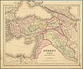
1855 Colton Map of Turkey, Iraq, and Syria - Geographicus - TurkeyIraq-colton-1855.jpg 3,500 × 3,034; 3.22 MB
-
Composite. Europaischen Russland. 1855. (A).jpg 1,811 × 1,250; 702 KB
-
Composite. Europaischen Russland. 1855. (B).jpg 934 × 627; 276 KB
-
Composite. Europaischen Russland. 1855. (C).jpg 756 × 348; 128 KB
-
Фрагмент карты восточного Кавказа 1855.jpg 715 × 571; 199 KB
-
1855 Karte vom Kaukasus - F. Handke.jpg 6,972 × 4,639; 7.41 MB
-
Colton, G.W. Turkey In Asia And The Caucasian Provinces Of Russia. 1856 (A).jpg 4,858 × 4,206; 6.06 MB
-
Colton, G.W. Turkey In Asia And The Caucasian Provinces Of Russia. 1856 (B).jpg 2,153 × 1,366; 1.02 MB
-
Colton, G.W. Turkey In Asia And The Caucasian Provinces Of Russia. 1856 (BC).jpg 1,124 × 542; 239 KB
-
Colton, G.W. Turkey In Asia And The Caucasian Provinces Of Russia. 1856 (C).jpg 1,154 × 1,211; 524 KB
-
Colton, G.W. Turkey In Asia And The Caucasian Provinces Of Russia. 1856.jpg 5,970 × 5,650; 7.56 MB
-
Karte des Kaukasischen Isthmus - Entworfen und gezeichnet von J-Grassl - 1856.jpg 8,925 × 6,640; 16.36 MB
-
Фрагмент карты Имамата на 27 мухаррама 1273 г.jpg 5,000 × 5,684; 12.85 MB
-
Colton's Turkey in Asia and the Caucasian Provinces of Russia.jpg 9,676 × 8,079; 18 MB
-
1858 map by H. Kiepert - Karte von Armenien, Kurdistan und Azerbeidschan.jpg 13,278 × 8,941; 32.97 MB
-
1858 map by H. Kiepert - Karte von Armenien, Kurdistan und Azerbeidschan.png 13,278 × 8,941; 297.42 MB
-
General map of the Caucasus region - 1858.jpg 10,499 × 8,642; 49.86 MB
-
Afghanistan and Persia in 1856.jpg 3,481 × 2,955; 1.39 MB
-
August von Haxthausen. Transcaucasia. The Caucasus map.jpg 5,140 × 8,753; 3.21 MB
-
Colton, G.W. Turkey In Asia And The Caucasian Provinces Of Russia. 1856 (BA).jpg 1,621 × 993; 565 KB
-
Colton, G.W. Turkey In Asia And The Caucasian Provinces Of Russia. 1856 (BK).jpg 1,251 × 741; 396 KB
-
Dagestan 1851.png 858 × 798; 1.44 MB
-
Map of Russia.B. Caucasus. George Dodd. Pictorial history of the Russian war 1854-5-6.jpg 8,429 × 3,823; 1.93 MB
-
W & A.K. Johnston. European Russia. 1850.jpg 550 × 682; 127 KB


