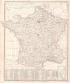
Category:1848 maps of France
Jump to navigation
Jump to search
Media in category "1848 maps of France"
The following 9 files are in this category, out of 9 total.
-
AL Roche-Huon. Extrait du cadastre Napoléon de 1848.png 874 × 1,175; 1.35 MB
-
Carte du département du Calvados - 1848.jpg 8,832 × 6,496; 8.05 MB
-
Jacques Baquol-Carte du Bas-Rhin.jpg 958 × 1,245; 716 KB
-
Karte von Frankreich Platt 1848.pdf 2,447 × 2,918; 1 MB
-
Plan et Profil de la Promenade du Broglie (cropped).jpg 912 × 614; 198 KB
-
Plan et Profil de la Promenade du Broglie et de la place du théâtre.jpg 1,385 × 1,006; 431 KB
-
Plan partiel de la ville d'Aix. La Juiverie. Roux-Alphéran. Gasquy. 1848.jpg 1,442 × 667; 257 KB


