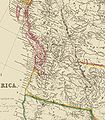
Category:1844 maps of Oregon
Jump to navigation
Jump to search
States of the United States: California · Georgia · Maryland · Oklahoma · Oregon · Pennsylvania · Texas
Media in category "1844 maps of Oregon"
The following 5 files are in this category, out of 5 total.
-
Arrowsmith Oregon Country.jpg 2,552 × 2,926; 1.65 MB
-
Jedediah Smith map by George Gibbs - WDL.png 1,668 × 996; 2.97 MB
-
Map of the Oregon Territory by the U. S. Ex. Ex (cropped).png 2,559 × 3,940; 20 MB
-
Map of the Oregon Territory by the U. S. Ex. Ex.png 7,000 × 4,843; 62 MB
-
Map of the Oregon Territory LOC 2004627252.jpg 10,339 × 7,014; 10.59 MB


