Category:1840s maps of the Russian Empire
Jump to navigation
Jump to search
Subcategories
This category has the following 8 subcategories, out of 8 total.
Media in category "1840s maps of the Russian Empire"
The following 4 files are in this category, out of 4 total.
-
 1843. Атлас Грибовского. Лист 6. Карта Воронежской губернии.djvu 3,404 × 2,477; 829 KB
-
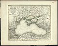 1845 map - Neueste Karte der Küstenländer des Schwarzen Meeres.jpg 11,510 × 9,236; 19.18 MB
-
 Ойрат-қалмақ тайпаларының қоныстану ареалы(1847).jpg 2,722 × 1,971; 1.41 MB
-
 Карта Внутренней Киргизской Орды 1842.jpg 5,004 × 6,166; 10.49 MB

.jpg)
