Category:1840s maps of Saxony
Jump to navigation
Jump to search
|
Federal states of Germany: |
Subcategories
This category has the following 11 subcategories, out of 11 total.
- 1841 maps of Saxony (3 F)
B
- Oberreit, Sect. Bautzen, 1844–46 (153 F)
F
G
O
- Oberreit, Sect. Oschatz, 1839–40 (116 F)
P
W
- Oberreit, Sect. Weißenberg, 1840 (11 F)
Z
- Oberreit, Sect. Zittau, 1844–46 (104 F)
Media in category "1840s maps of Saxony"
The following 12 files are in this category, out of 12 total.
-
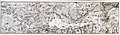
 Der Voigtlaendische Kreis.jpg 4,753 × 5,814; 7.72 MB
-
 Grundriss und Profil der Chemnitz - Riesaer Eisenbahn.jpg 8,673 × 6,586; 11.22 MB
-
 Krystallpalast Leipzig 1847.jpg 1,575 × 1,141; 1.47 MB
-
 Die Sächsischen Anhaltischen u Schwarzenburgischen Länder Platt 1848.pdf 2,977 × 2,375; 767 KB
-
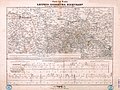
 Cantonnement der 2. Linien-Infanterie-Brigade im September 1839.jpg 7,515 × 9,032; 19.46 MB
-
 Charte des Laufes der Leipzig-Dresdner Eisenbahn.jpg 13,679 × 10,235; 25.58 MB
-
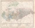
 Meyer‘s Zeitungsatlas 020 – Sachsen, die Staaten von Thüringen und benachbarte Länder.jpg 7,351 × 6,251; 16.91 MB
-

-

-

-
-
 Übersicht der verschiedenen in Vorschlag gebrachten Eisenbahnlinien Sachsens.jpg 11,503 × 8,075; 9.59 MB


