Category:1840s maps of Istanbul
Jump to navigation
Jump to search
Most populous urban areas of the world: Boston [US] · Chicago [US] · Istanbul [TR] · London [GB] · New York City [US] · Paris [FR] · Philadelphia [US] · São Paulo [BR] · Toronto [CA] · Washington, D.C. [US]
19th-century maps of Istanbul: ◀ · 1800s · 1810s · 1820s · 1830s · 1840s · 1850s · 1860s · 1870s · 1880s · 1890s · ▶
Media in category "1840s maps of Istanbul"
The following 8 files are in this category, out of 8 total.
-
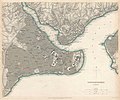
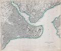
1840 map of Constantinople.jpg 4,880 × 4,044; 3.71 MB
-
1840 map of Istanbul.jpg 4,400 × 3,673; 5.2 MB
-
Taksim area in 1840.png 1,235 × 602; 1.58 MB
-
Taksim Gezi Park in 1841 Turkish Roman Catholic Armenian cemeteries.png 1,234 × 1,000; 1.5 MB
-
1843 map of İstanbul.jpg 3,071 × 2,561; 2.03 MB
-
Constantinople (1844).png 9,909 × 8,411; 150.64 MB
-
Istanbul 1845.jpg 15,276 × 19,012; 51.02 MB


