Category:1840s maps of Hungary
Appearance
Subcategories
This category has only the following subcategory.
Media in category "1840s maps of Hungary"
The following 8 files are in this category, out of 8 total.
-
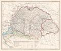
Die Ungarischen Länder mit einem Theil von Galizien Platt 1848.pdf 2,797 × 2,358; 786 KB
-
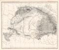
Oro- und Hydrographische Karte vom Karpathenland Platt 1848.pdf 2,827 × 2,379; 630 KB
-
Meyer‘s Zeitungsatlas 013 – Ungarn und Siebenbürgen.jpg 7,386 × 6,224; 18.08 MB
-
The War Theater in Southern Hungary in 1849.jpg 8,274 × 6,114; 9.15 MB
-
Ungarn BV042755975.jpg 1,706 × 3,159; 1.19 MB
-
Ungarn BV042756035.jpg 1,724 × 3,175; 1.1 MB
-
Ungarn BV042756097.jpg 3,710 × 3,057; 1.68 MB
-
469 of 'Memoiren ... April bis October 1849. Original Ausgabe' (11033771874).jpg 4,322 × 3,762; 4.36 MB


