Category:1840 maps of Schleswig-Holstein
Jump to navigation
Jump to search
Federal states of Germany:
Media in category "1840 maps of Schleswig-Holstein"
The following 3 files are in this category, out of 3 total.
-
Grundriss Der Freien Stadt Lübeck.jpg 8,108 × 6,218; 20.2 MB
-
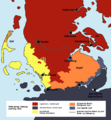
SprogforholdSlesvig.png 824 × 889; 262 KB
-
WP St.-Annen-Kirchhof - Lagevergleich.jpg 1,857 × 2,294; 3.6 MB


