Category:1839 maps of Asia
Jump to navigation
Jump to search
Temperate regions: North America · South America · Africa · Europe · Asia · Oceania – Polar regions: – Other regions:
English: 1839 maps of Asia
Español: Mapas de Asia en 1839
Subcategories
This category has the following 2 subcategories, out of 2 total.
I
- 1839 maps of India (3 F)
J
- 1839 maps of Japan (2 F)
Media in category "1839 maps of Asia"
The following 7 files are in this category, out of 7 total.
-
 1839 map of the countries lying between Turkey & Birmah by James Wyld.tif 25,922 × 18,936; 1.37 GB
-

-
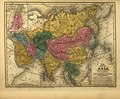
 Map of Asia, Mitchell's School Atlas LOC 2007633727-13 (cropped).jpg 3,117 × 2,378; 1.79 MB
-

-

-
 Mitchell's school atlas LOC 2007633727-13.jpg 3,402 × 2,814; 1.97 MB
-
 Mitchell's school atlas LOC 2007633727-13.tif 3,402 × 2,814; 27.39 MB
_with_Lhasa_(Lassa)_capitol_and_India_(Hindoostan)_with_Calcutta_capitol_in_1839_from_Mitchell%27s_School_Atlas_LOC_2007633727-13_(cropped).jpg)
.jpg)
_and_Lhasa_(Lassa)_in_1839,_Polar_projection,_from_Mitchell%27s_School_Atlas_LOC_2007633727-4_(cropped).jpg)
_and_Lhasa_(Lassa)_in_1839,_equatorial_projection,_from_Mitchell%27s_School_Atlas_LOC_2007633727-4_(cropped).jpg)
