Category:1836 maps of Mexico
Jump to navigation
Jump to search
Media in category "1836 maps of Mexico"
The following 4 files are in this category, out of 4 total.
-
Austin & Tanner Map of Texas with Parts of the Adjoining States 1836 UTA.jpg 7,003 × 8,786; 13.33 MB
-
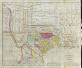
Hooker Map of the State of Coahuila and Texas 1836 UTA.jpg 4,122 × 3,436; 11.07 MB
-
Lizars Mexico & Guatimala 1836 UTA (cropped).jpg 6,247 × 5,049; 16.37 MB
-
Lizars Mexico & Guatimala 1836 UTA.jpg 6,566 × 5,320; 14 MB


