Category:1820s maps of South Carolina
Jump to navigation
Jump to search
States of the United States: Alabama · Alaska · Delaware · Florida · Georgia · Hawaii · Illinois · Indiana · Kentucky · Louisiana · Maine · Maryland · Massachusetts · Michigan · Mississippi · Missouri · New Hampshire · New Jersey · New York · Ohio · Pennsylvania · Rhode Island · South Carolina · South Dakota · Tennessee · Utah · Vermont · Virginia
Media in category "1820s maps of South Carolina"
The following 18 files are in this category, out of 18 total.
-
 1822 map of Charleston Harbor, South Carolina.jpeg 1,169 × 2,070; 431 KB
-
 1827 Finley Map of South Carolina - Geographicus - SouthCarolina-finley-1827.jpg 3,000 × 2,343; 1.73 MB
-
 Charleston District, South Carolina LOC 2006636553.jpg 10,353 × 10,684; 12.5 MB
-
 Charleston District, South Carolina LOC 2006636553.tif 10,353 × 10,684; 316.46 MB
-
 Counties Charleston, Colleton and Beaufort on 1827 Finley Map.jpg 1,245 × 1,045; 397 KB
-

-

-
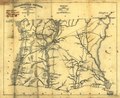
 Marion District, South Carolina LOC 2007627674.jpg 6,947 × 8,504; 7.28 MB
-
 Marion District, South Carolina LOC 2007627674.tif 6,947 × 8,504; 169.02 MB
-
 Mills1825SE 250.gif 247 × 138; 6 KB
-
 Richland District, South Carolina LOC 2007627903.jpg 5,390 × 5,917; 4.92 MB
-
 Richland District, South Carolina LOC 2007627903.tif 5,390 × 5,917; 91.25 MB
-
 Union District, South Carolina LOC 2007627924.jpg 4,563 × 5,008; 2.62 MB
-
 Union District, South Carolina LOC 2007627924.tif 4,563 × 5,008; 65.38 MB
-
 Williamsburgh District, South Carolina - LOC 2007627941.jpg 6,399 × 5,232; 4.38 MB
-
 Williamsburgh District, South Carolina - LOC 2007627941.tif 6,399 × 5,232; 95.79 MB
-
 York District, South Carolina LOC 2007627952.jpg 7,575 × 4,986; 3.95 MB
-
 York District, South Carolina LOC 2007627952.tif 7,575 × 4,986; 108.06 MB


