Category:1820s maps of Central America
Jump to navigation
Jump to search
Media in category "1820s maps of Central America"
The following 11 files are in this category, out of 11 total.
-
 A map of Mosquitia and the territory of Poyais with the Adjacent Countries,.jpg 5,645 × 7,682; 13.29 MB
-

-
 Guatemala, ou Provinces-Unies de L'Amérique Centrale.jpg 11,705 × 8,336; 15.44 MB
-

-
 Map of Guatemala- Reduced from the Survey in the Archives of that Country, 1826 WDL146.png 1,284 × 1,024; 2.06 MB
-
 Partie du Guatemala. Amer. Sep. 72.jpg 9,076 × 6,731; 10.26 MB
-
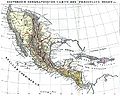 Mexiko und Mittelamerika 1829.JPG 3,064 × 2,448; 1.53 MB
-
 Capitanía General de Guatemala ante Imperio Mexicano 1822.png 1,290 × 1,122; 285 KB
-
 Geographical, statistical and historical map of Central America.jpg 4,673 × 4,526; 4.88 MB
-

-
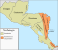 Provincias Capitanía General de Guatemala 1821.png 1,290 × 1,123; 207 KB


