Category:1818 maps
Jump to navigation
Jump to search
| ← · 1810 · 1811 · 1812 · 1813 · 1814 · 1815 · 1816 · 1817 · 1818 · 1819 · → |
Deutsch: Karten mit Bezug zum Jahr 1818
English: Maps related to the year 1818
Español: Mapas relativos al año 1818
Français : Cartes concernant l’an 1818
Русский: Карты 1818 года
Subcategories
This category has the following 7 subcategories, out of 7 total.
A
E
G
N
S
Media in category "1818 maps"
The following 120 files are in this category, out of 120 total.
-
(1818) Map of Edinburgh.jpg 6,071 × 4,785; 6.15 MB
-
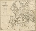
GIBBON(1818) p1.048 MAP OF THE WESTERN PART OF ROMAN EMPIRE.jpg 2,761 × 2,390; 4.55 MB
-
GIBBON(1818) p2.518 MAP OF THE EASTERN PART OF ROMAN EMPIRE.jpg 2,505 × 2,387; 4.13 MB
-
1818 Karte Domänengut Ewig.jpg 9,820 × 5,344; 8.43 MB
-
1818 map of South Carolina.jpeg 2,654 × 2,390; 912 KB
-
1818 Pinkerton Map of Beligum - Geographicus - Belgium-pinkerton-1818.jpg 5,000 × 3,632; 4.97 MB
-
1818 Pinkerton Map of Chile - Geographicus - Chili-pinkerton-1818.jpg 3,661 × 5,000; 3.76 MB
-
1818 Pinkerton Map of France - Geographicus - France-pinkerton-1818.jpg 5,000 × 3,653; 4.95 MB
-
1818 Pinkerton Map of Holland or the Netherlands - Geographicus - Holland-pinkerton-1818.jpg 5,000 × 4,457; 6.09 MB
-
1818 Pinkerton Map of Ireland - Geographicus - Ireland-pinkerton-1818.jpg 3,645 × 5,000; 5.38 MB
-
1818 Pinkerton Map of Northern Scotland - Geographicus - ScotlandNorth-pinkerton-1818.jpg 5,000 × 3,724; 4.71 MB
-
1818 Pinkerton Map of Peru - Geographicus - Peru-pinkerton-1818.jpg 6,000 × 4,393; 6.5 MB
-
1818 Pinkerton Map of Portugal - Geographicus - Portugal-pinkerton-1818.jpg 3,618 × 5,000; 4.77 MB
-
1818 Pinkerton Map of South America - Geographicus - SouthAmerica-pinkerton-1818.jpg 3,603 × 5,000; 4.82 MB
-
1818 Pinkerton Map of Southern Scotland - Geographicus - ScotlandSouth-pinkerton-1818.jpg 5,000 × 3,711; 5.78 MB
-
A NEW AND CORRECT PLAN of the CITY of BATH (1818).jpg 2,710 × 2,936; 5.89 MB
-
A chart of the world on Mercator's projection RMG F1970.tiff 7,205 × 4,905; 101.11 MB
-
A map of Brazil, now called New Portugal. LOC 2003627077.jpg 5,148 × 6,312; 4.56 MB
-
A map of Brazil, now called New Portugal. LOC 2003627077.tif 5,148 × 6,312; 92.97 MB
-
A map of Palestine or the Holy land with the divisions into tribes (FL35081008 3890220).jpg 6,035 × 7,282; 62.3 MB
-
A new map of the West Indies, for the history of the British Colonies (4587172928).jpg 2,000 × 1,290; 1.98 MB
-
Asia LOC 2006636622.jpg 8,964 × 6,351; 9.22 MB
-
Asia LOC 2006636622.tif 8,964 × 6,351; 162.88 MB
-
Australasia. LOC 00552204.jpg 8,409 × 6,239; 6.77 MB
-
Australasia. LOC 00552204.tif 8,409 × 6,239; 150.1 MB
-
Baltimore, Annapolis, and adjacent country. NYPL484917.tiff 2,657 × 2,320; 17.64 MB
-
Bartolomeo Borghi, L'Egitto (FL25570106 2499964).jpg 8,907 × 11,864; 132.13 MB
-
Charte von den Vereinigten Staaten von Nord-America mit Luisiana. LOC 2002621134.tif 5,869 × 4,217; 70.81 MB
-
Chile LOC 2017594101.jpg 6,193 × 8,801; 7.76 MB
-
Chile LOC 2017594101.tif 6,193 × 8,801; 155.94 MB
-
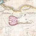
Christoph Fembo, Africa Propria et Cyrenaica (FL13726077 2496141).jpg 3,371 × 2,889; 12.92 MB
-
Christoph Fembo, Mauretania et Numidia (FL13726095 2496137).jpg 3,312 × 2,856; 13.83 MB
-
German cartographer, Palaestina (FL6882694 2370234).jpg 6,460 × 9,372; 86.48 MB
-
Jacob Auspitz, איש על דגלו באתת לבית אבותם יחנו בני ישראל. לוח ב' ג' (FL37098922 2369231).jpg 5,160 × 4,090; 23.91 MB
-
John Pinkerton. Map of Persia. 1818.D. Erivan.jpg 624 × 373; 96 KB
-
John Pinkerton. Map of Persia. 1818.E. Shirvan.jpg 469 × 511; 86 KB
-
John Pinkerton. Map of Persia. 1818.F. Daghistan.jpg 284 × 315; 37 KB
-
Josephus, Map of the Holy Land from the best authorities (FL45602032 3934943).jpg 5,008 × 3,198; 3.74 MB
-
Kaart van de Goud-Kust of Kust van Guinea (1818).jpg 7,377 × 5,983; 3.16 MB
-
L1071.png 320 × 237; 157 KB
-
La Judee diviseé en douze Tribus (FL36554994 3898814).jpg 5,323 × 4,426; 30.65 MB
-
Map of Illinois (4584052972).jpg 1,468 × 2,000; 2.57 MB
-
Map of Illinoise (sic) LOC 2003627085.jpg 6,052 × 8,353; 7.57 MB
-
Map of Illinoise (sic) LOC 2003627085.tif 6,052 × 8,353; 144.63 MB
-
Map of Tennessee (8250888188).jpg 2,000 × 1,358; 2.47 MB
-
Map of the United States including Louisiana. LOC 98685568.tif 5,847 × 4,776; 79.9 MB
-
Noord-Holland 1818 (25116002542).jpg 7,088 × 5,814; 9.24 MB
-
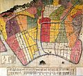
Okishindentouzai.jpg 629 × 578; 111 KB
-
Pierre Antoine Tardieu, La Palestine (FL27932975 2369501).jpg 10,961 × 7,231; 92.29 MB
-
Pinkerton Map 1818 - Recolour v1.6.tif 5,317 × 3,973; 60.46 MB
-
Plan Lyon 1818.jpg 6,216 × 4,221; 12.8 MB
-
Segunda Campaña del Sur 1.jpg 933 × 682; 233 KB
-
Segunda Campaña del Sur 2.jpg 933 × 682; 236 KB
-
Sutton Court and Chiswick House Peter Potter 1818.jpg 768 × 572; 184 KB
-
Swisserland LOC 2009579458.jpg 11,382 × 8,419; 14.26 MB
-
Swisserland LOC 2009579458.tif 11,382 × 8,419; 274.16 MB
-
The state of Georgia. LOC 2006635240.jpg 4,708 × 5,802; 3.38 MB
-
The state of Georgia. LOC 2006635240.tif 4,708 × 5,802; 78.15 MB
-
The state of New York with part of the adjacent states (4583423517).jpg 2,000 × 1,757; 3.83 MB
-
The state of Rhode Island (7537853864).jpg 1,421 × 2,000; 2.49 MB
-
The world on Mercator's projection, LOC 78692119.jpg 14,991 × 11,440; 21.1 MB
-
The world on Mercator's projection, LOC 78692119.tif 14,991 × 11,440; 490.66 MB
-
Tombongabelle01.jpg 961 × 1,101; 1.15 MB
-
Tombongabelle02.jpg 2,171 × 2,191; 2.73 MB
-
Tranquillo Mollo, Asien (FL27955352 2475888).jpg 11,110 × 8,382; 128.22 MB
-
Tranquillo Mollo, Australien (FL27963662 2518624).jpg 11,072 × 8,405; 125.42 MB
-
Tranquillo Mollo, Charte vom Nil-Strome (FL13723649 2493588).jpg 5,980 × 7,496; 68.13 MB
-
Tranquillo Mollo, Charte von Ost-Indien (FL27950852 2475728).jpg 12,235 × 9,190; 158.38 MB
-
Tranquillo Mollo, Charte von West-Indien (FL13728510 2510750).jpg 8,189 × 6,174; 75.43 MB
-
Tranquillo Mollo, Die beyden Halbkugeln (FL13736319 2718534).jpg 7,986 × 6,228; 66.25 MB
-
Tranquillo Mollo, Karte von Russland in Europa (FL36379306 2606663).jpg 9,050 × 11,748; 155.25 MB
-
Tranquillo Mollo, Persien und Arabien (FL33131143 2490680).jpg 11,590 × 8,873; 143.33 MB
-
Tranquillo Mollo, Welt Karte (FL27969718 2718465).jpg 11,505 × 9,034; 131.63 MB
-
Washington 1818 edited.jpg 9,398 × 7,358; 47.05 MB
-
Washington 1818.jpg 9,613 × 7,617; 69.04 MB
-
Zeller Esch.jpg 619 × 572; 147 KB

