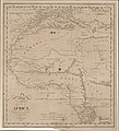
Category:1816 maps of Africa
Jump to navigation
Jump to search
Temperate regions: North America · South America · Africa · Europe · Asia · – Polar regions: – Other regions:
| ← 1810 1811 1812 1813 1814 1815 1816 1817 1818 1819 → |
Media in category "1816 maps of Africa"
The following 9 files are in this category, out of 9 total.
-
1816 French map of the Barbary Coast.jpg 11,193 × 7,649; 19.19 MB
-
Maghreb 1816.jpg 415 × 311; 122 KB
-
Life-expectancy,Africa,1816.svg 850 × 691; 12 KB
-
Plan of the city and fortifications of algiers - 1816.jpg 1,500 × 1,206; 172 KB
-
Europas Kolonien. 1 1885 (150828393).jpg 3,612 × 2,589; 4.83 MB


