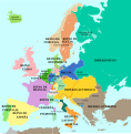
Category:1815 maps of Europe
Jump to navigation
Jump to search
English: 1815 maps of Europe
Español: Mapas de Europa en 1815
Suomi: Euroopan kartat vuodelta 1815
Română: Hărți ale Europei din 1815
Subcategories
This category has the following 4 subcategories, out of 4 total.
Media in category "1815 maps of Europe"
The following 16 files are in this category, out of 16 total.
-
Charte von Europa in 4 Blaettern.jpg 14,678 × 12,342; 28.56 MB
-
Europa 1815-es.svg 1,340 × 1,363; 1 MB
-
Europa 1815-pt.svg 1,340 × 1,363; 559 KB
-
Europa 1815.svg 1,340 × 1,363; 554 KB
-
Europe 1815 map de.png 2,284 × 1,503; 1.07 MB
-
Europe 1815 monarchies versus republics.png 2,000 × 2,027; 397 KB
-
Europe1815 1905.jpg 1,503 × 1,188; 823 KB
-
Euròpa après lo Congrès de Viena (1815).png 757 × 477; 239 KB
-
Helsinki 1815.jpg 1,538 × 1,896; 400 KB
-
Kungliga djurgården 1815 Akt 01-1668.png 3,339 × 11,787; 58.25 MB
-
L'Europe dans son état actuel - dressée par Hérisson... - btv1b53092960k.jpg 8,384 × 6,712; 10.14 MB
-
Location of the Grand Duchy of Baden within Europe in 1815.svg 450 × 456; 672 KB
-
Map congress of vienna.jpg 767 × 594; 325 KB
-
欧洲 - 1815.svg 905 × 762; 1.11 MB


