Category:1808 maps of Africa
Jump to navigation
Jump to search
Temperate regions: North America · South America · Africa · Europe · Asia · – Polar regions: – Other regions:
| ← 1800 1801 1802 1803 1804 1805 1806 1807 1808 1809 → |
Media in category "1808 maps of Africa"
The following 9 files are in this category, out of 9 total.
-
Africa - DPLA - 3836a7b940ab03ba99ed6d4bdd2c5cd1.jpg 726 × 1,001; 141 KB
-
Africa - DPLA - caddf4dd37316dd42471deea65b44507.jpg 1,000 × 836; 231 KB
-
Africa 1808.jpg 2,020 × 1,740; 897 KB
-
Africa, including the Mediterranean (5961362258).jpg 1,688 × 2,000; 3.35 MB
-
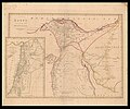
Jean Baptiste Bourguignon d'Anville, Egypt from d'Anville (FL35077167 3887441).jpg 12,518 × 10,457; 167.21 MB
-
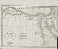
John Wilkes of Milland House, Sussex, Egypt (FL25570079 2500742).jpg 5,308 × 6,696; 47.87 MB
-
Life-expectancy,Africa,1808.svg 850 × 691; 12 KB


