Category:1802 maps of the United States
Jump to navigation
Jump to search
Countries of the Americas: Canada · United States of America
States of the United States: Ohio · Pennsylvania
Subcategories
This category has the following 4 subcategories, out of 4 total.
Media in category "1802 maps of the United States"
The following 29 files are in this category, out of 29 total.
-
A map of the State of New York. LOC gm71005384.jpg 16,207 × 20,302; 58.39 MB
-
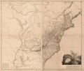
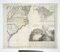
A map of the United States of North America LOC 2014589399.jpg 17,381 × 15,087; 36.2 MB
-
A map of the United States of North America LOC 2015588795.jpg 17,760 × 15,153; 34.51 MB
-
A map of the United States of North America LOC 2015588795.tif 17,760 × 15,153; 769.95 MB
-
Carte du Missouri - levee ou rectifiée dans toute son etendue LOC 2003627086.jpg 4,779 × 3,703; 2.43 MB
-
Carte du Missouri - levee ou rectifiée dans toute son etendue LOC 2003627086.tif 4,779 × 3,703; 50.63 MB
-
Map of the State of New York, by Simeon De Witt, 1802.jpg 15,947 × 19,962; 60.4 MB
-
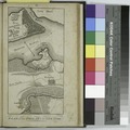
Road from Philada. to New York, seg. 15.) NYPL484172.tiff 4,178 × 4,163; 49.77 MB
-
Road from Philadela. to New York seg. 2-3 NYPL484916.tiff 4,079 × 4,142; 48.34 MB
-
Road from Philadela. to New York, seg. 4-5. NYPL484166.tiff 4,121 × 4,121; 48.59 MB
-
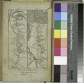
Road from Philadela. to New York, seg. 6-7.) NYPL484167.tiff 4,479 × 4,192; 53.73 MB
-
Road from Philadela. to Washington, seg. 17-18.) NYPL484174.tiff 4,072 × 4,051; 47.2 MB
-
Road from Philadela. to Washington, seg. 19-20 NYPL484175.tiff 4,241 × 4,121; 50.01 MB
-
Road from Philadelphia to New York, seg. 10-11.) NYPL484169.tiff 4,283 × 4,192; 51.37 MB
-
Road from Philadelphia to New York, seg. 12-13.) NYPL484170.tiff 4,283 × 4,192; 51.37 MB
-
Road from Philadelphia to New York, seg. 14.) NYPL484171.tiff 4,311 × 4,269; 52.66 MB
-
Road from Philadelphia to New York, seg. 8-9.) NYPL484168.tiff 4,283 × 4,192; 51.37 MB
-
Road from Philadelphia to Washington. NYPL433647.tiff 4,163 × 4,121; 49.09 MB
-
Sketch plan for landscaping the grounds of the President's House, ca. 1802-05. LOC 88693237.tif 5,040 × 6,312; 91.02 MB
-
United States of Nth. America = Carte des Etats-Unis de L'Amerique Septentrionale LOC 98685633.jpg 17,173 × 15,132; 41.01 MB
-
Vue de la colonie espagnole du Mississippi en 1802 - carte reduite Haute Louisiane.jpg 1,059 × 1,200; 883 KB
-
Washington city - I. Draper sc. NYPL433646.tiff 2,305 × 3,288; 21.69 MB


