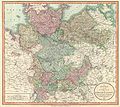
Category:1800s maps of Mecklenburg-Vorpommern
Jump to navigation
Jump to search
|
Federal states of Germany: |
Media in category "1800s maps of Mecklenburg-Vorpommern"
The following 5 files are in this category, out of 5 total.
-
Carte von Meklenburg - btv1b53100500c.jpg 9,815 × 6,615; 10.26 MB
-
Siège de 1807 par les Français et alliés, commandés par le maréchal Brune - btv1b8440633m.jpg 10,365 × 8,758; 10.03 MB


