Category:1800s maps of England and Wales
Jump to navigation
Jump to search
Subcategories
This category has the following 2 subcategories, out of 2 total.
1
- 1800s maps of Wales (4 F)
Media in category "1800s maps of England and Wales"
The following 14 files are in this category, out of 14 total.
-
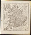
 Aikin(1800) p012 - England and Wales.jpg 2,688 × 2,183; 1.18 MB
-
-
 Map of England and Wales Wellcome V0049911.jpg 2,494 × 2,815; 3.25 MB
-
 Atlas moderne portatif 1804 (84187790).jpg 6,214 × 5,257; 4.38 MB
-
 Cary's Traveller's companion 1806 (72194605).jpg 2,675 × 4,357; 2.22 MB
-
 Cary's Traveller's companion 1806 (72194725).jpg 10,236 × 11,925; 21 MB
-

-
 1807 England Wales Letter circulation map.jpg 1,100 × 1,246; 242 KB
-
 The Circulation of Letters to and from (BM J,11.5).jpg 2,098 × 2,500; 678 KB
-

-
 The Circulation of Letters to and from (BM J,11.2).jpg 2,105 × 2,500; 689 KB
-
 The Circulation of Letters to and from (BM J,11.3).jpg 1,906 × 2,500; 564 KB
-
 The Circulation of Letters to and from (BM J,11.4).jpg 2,068 × 2,500; 667 KB
-

_p012_-_England_and_Wales.jpg)
.jpg)

.jpg)
.jpg)
.jpg)
.jpg)

.jpg)

.jpg)
.jpg)
.jpg)
)%27_(11009994184).jpg)