Category:17th-century maps of the Malay Archipelago
Jump to navigation
Jump to search

English: Note: The Malay Archipelago may also be called East Indies or East Indian Archipelago or a similar name on maps of the era of European exploration and colonization. It comprises of the islands marked green in the map of the right side. Please only include maps here that show the whole or most of the archipelago. Maps focusing on specific islands or focusing or certain countries, should go in the corresponding category of that island or country.
Subcategories
This category has the following 10 subcategories, out of 10 total.
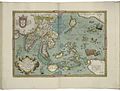
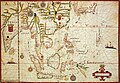
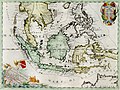
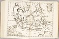
Media in category "17th-century maps of the Malay Archipelago"
The following 45 files are in this category, out of 45 total.
-
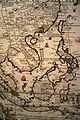
 "Asiae Nova Descriptio," by P. Kaerius, 1614 - southeast.jpg 800 × 600; 149 KB
-

-

-

-
 Map of India and the Maluku Islands by Abraham Ortelius.jpeg 1,562 × 1,186; 596 KB
-

-
 B26055951K - Mar di India.jpg 6,168 × 5,435; 7.72 MB
-
 Map of SE Asia, Dutch East Indies, & Philippines LCCN2003663634.jpg 1,536 × 1,142; 433 KB
-
 Map of SE Asia, Dutch East Indies, & Philippines LCCN2003663634.tif 1,536 × 1,142; 1.68 MB
-
 AMH-6920-KB Map of South East Asia with an inset showing the Botton Strait.jpg 2,400 × 1,723; 1.03 MB
-
 B26056032B - Insula India orientalis.jpg 5,943 × 4,621; 7.34 MB
-
 Atlas ou Representation du Monde Universel t. 2. 1633 (110102987).jpg 17,129 × 12,037; 34.61 MB
-

-

-
 Map of Asia from 1641.jpg 2,970 × 2,062; 1.46 MB
-
 A-3-37-12-East-Indies.jpg 3,000 × 2,292; 967 KB
-

-

-

-
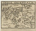
 Tabula Indiae orientalis (8357192637).jpg 800 × 655; 143 KB
-
 Thevenot - Hollandia Nova detecta 1644.png 2,916 × 2,310; 3.66 MB
-
 Nova Archipelagi Orientalis Tabula Joan Blaeu 6663.png 979 × 756; 1.71 MB
-
 East Indies RMG K0963.jpg 1,016 × 1,280; 1.46 MB
-
 Map of the East Indies and the Indian Ocean, Pierre Du Val 1665.jpg 883 × 675; 197 KB
-
 MapEastIndian-PieterGoos.jpg 377 × 312; 46 KB
-
 B26055973D - A new map of East India.jpg 6,768 × 5,302; 8.89 MB
-
 B26055919D - Isole dell'Indie divise in Filippine, Molucche e della Sonda.jpg 6,404 × 4,820; 9.1 MB
-
 Cartes generales de toutes les parties du monde 1681 (127471719).jpg 12,698 × 9,409; 15.59 MB
-
 The Molucca Isles; Isles of Japan; The Philippine Islands (NYPL b14428893-1503445).jpg 5,248 × 6,299; 7.1 MB
-
 AMH-6177-NA Map of the Chinese sea and coast.jpg 2,400 × 1,960; 646 KB
-
 HoangSaVN-DongNamA1687.jpg 3,150 × 1,800; 1.92 MB
-
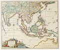
 Van Keulen-Nieuwe Pascaert van Oost Indien-1680-1735-2.jpg 4,766 × 4,158; 11.41 MB
-
 B26056049J - Insula India orientalis.jpg 5,964 × 4,505; 7.31 MB
-
 Atlante Veneto Volume 2 110.jpg 10,615 × 7,067; 7.43 MB
-

-
 Philipine Cambodge 1696 Nicolas de Fer 04984.jpg 3,264 × 4,912; 5.08 MB
-
 Dampier, Map of the East Indies.jpg 1,429 × 829; 360 KB
-
 AMH-5520-NA Map of Sumatra to the Moluccas.jpg 2,400 × 2,052; 716 KB
-
 India Orientalis - btv1b531793321 (1 of 2).jpg 1,482 × 1,282; 388 KB
-
 Insularum Indiae orientalis nova descriptio - CBT 6618009.jpg 5,750 × 4,462; 7.03 MB
-

-
 Nicolaes Visscher Indiae Orientalis.jpg 2,493 × 2,077; 1.89 MB
-
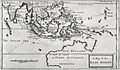
 17th century India Map from BERTIUS ATLAS MAPS.jpg 800 × 600; 144 KB
-
 Map of Oriental India and Meridional India.jpg 1,888 × 1,682; 397 KB
-
 Orientalis Idiae.jpg 2,069 × 1,718; 1.37 MB

.jpg)


.jpg)
,_NG-501-73.jpg)
.jpg)


.jpg)
_-_btv1b52511195b_(61_of_85).jpg)
.jpg)


.jpg)
.jpg)


.jpg)

,_NG-501-76.jpg)


