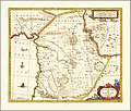
Category:17th-century maps of Lebanon
Jump to navigation
Jump to search
Subcategories
This category has the following 2 subcategories, out of 2 total.
#
- 1600s maps of Lebanon (1 F)
- 1680s maps of Lebanon (1 F)
Media in category "17th-century maps of Lebanon"
The following 2 files are in this category, out of 2 total.
-
Syriae Sive Soriae Nova et Accurata descriptio by Jan Janssonius.jpg 14,001 × 11,948; 26.79 MB
-
Syriae Sive Soriae Nova et Accurata descriptio.jpg 13,485 × 11,411; 26.32 MB

