Category:17th-century maps of Costa Rica
Jump to navigation
Jump to search
Countries of North America: The Bahamas · Barbados · Canada · Costa Rica · Cuba · Guatemala · Honduras · Jamaica · Mexico · Panama · Saint Kitts and Nevis · Trinidad and Tobago‡ · United States of America‡
Other territories: Bermuda · Greenland · Guadeloupe · Martinique · Puerto Rico
‡: partly located in North America
Other territories: Bermuda · Greenland · Guadeloupe · Martinique · Puerto Rico
‡: partly located in North America
Subcategories
This category has only the following subcategory.
Media in category "17th-century maps of Costa Rica"
The following 4 files are in this category, out of 4 total.
-
 A new map of the isthmus of Darien - btv1b5970801r.jpg 5,848 × 3,632; 3.02 MB
-

-
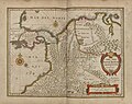 Terra Firma et novum regnum Granatense et Popayan. R 2= 22. Pièce 65.jpg 8,616 × 6,856; 10.56 MB
-
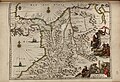 Terra Firma et novum regnum Granatense et Popayan. R 2= 22. Pièce 66.jpg 6,752 × 4,624; 6.34 MB


