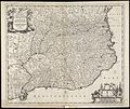
Category:17th-century maps of Catalonia
Jump to navigation
Jump to search
Autonomous communities of Spain: Andalusia · Aragon · Canary Islands · Catalonia · Galicia · Autonomous cities:
Subcategories
This category has the following 3 subcategories, out of 3 total.
Media in category "17th-century maps of Catalonia"
The following 19 files are in this category, out of 19 total.
-
" Catalonia vulgo Cataluña." (22227510436).jpg 3,907 × 3,039; 3.06 MB
-
Vegueries 1660.jpg 7,488 × 5,664; 6.48 MB
-
Catalonia - Atlas Maior, vol 10, map 17 - Joan Blaeu, 1667 - BL 114.h(star).10.(17).jpg 4,000 × 2,818; 1.66 MB
-
Principaute de Catalogne.jpg 1,733 × 1,300; 3.16 MB
-
Principatus Cataloniae.jpeg 2,696 × 2,172; 5.14 MB
-
Carte des Pyrénées au XVIIeme siècle.jpg 6,286 × 4,048; 10.61 MB
-
Catalonia, Blaeu.jpeg 2,832 × 2,228; 6.1 MB
-
Cataloniae principatus 1608.jpg 5,781 × 4,573; 9.95 MB
-
Escudo del Principado de Cataluña.jpeg 600 × 600; 437 KB
-
Map - Special Collections University of Amsterdam - OTM- HB-KZL 32.23.39.tif 7,389 × 6,385; 134.98 MB
-
Mataros (Adam Perelle, 1668).png 1,878 × 1,296; 5.09 MB
-
PlaRosesAtacfrancès.jpg 521 × 412; 107 KB
-
Reproducció d'un mapa de Catalunya de 1630 (AFCEC VINTRO D 4115).jpeg 1,024 × 682; 147 KB
-
Vegueries 1694.jpg 1,037 × 837; 570 KB


