Category:1799 maps of Lithuania
Jump to navigation
Jump to search
Media in category "1799 maps of Lithuania"
The following 6 files are in this category, out of 6 total.
-
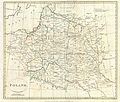
1799 Cary Map of Poland, Prussia and Lithuania - Geographicus - Poland-cary-1799.jpg 5,000 × 4,416; 7.6 MB
-
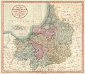
1799 Cary Map of Prussia and Lithuania - Geographicus - Prussia-cary-1799.jpg 5,000 × 4,364; 6.48 MB
-
Map of the partition of the Kingdom of Poland and the Grand Duchy of Lithuania from 1799.jpg 6,330 × 5,677; 6.83 MB
-
Part of map of Grand Dutchy of Lithuania including Samogitia, 1799.png 1,622 × 780; 2.82 MB


